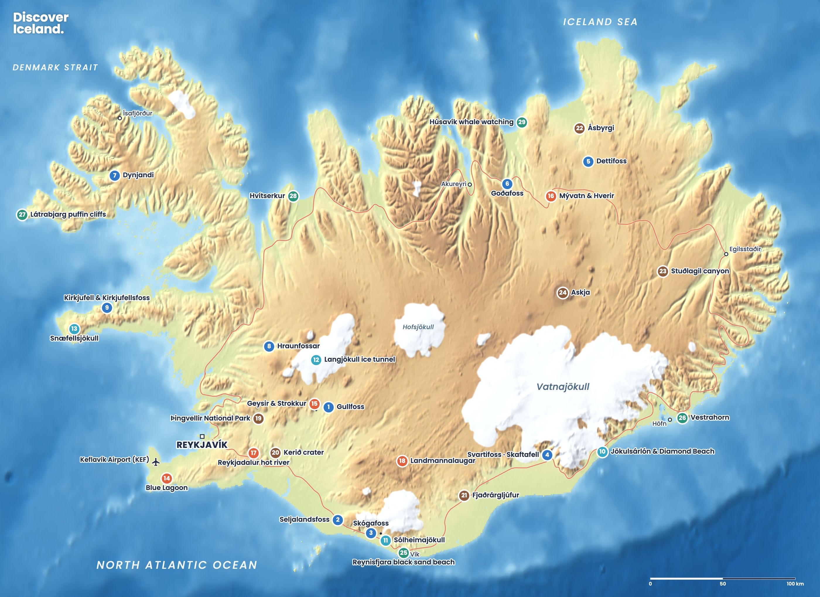
South coast Iceland is the stretch of Route 1 from Selfoss to Höfn, about 400 km of road with waterfalls, black beaches, glaciers and the iceberg lagoon at Jökulsárlón. You could drive it in a day, but you would see almost nothing. Two or three days, sleeping along the way, lets you stop at everything below. Here is every main stop in order, from west to east.
How long is the drive along Iceland's south coast?
Höfn is about 458 km from Reykjavík along the south coast, and Selfoss is about 50 km from the capital, so the Selfoss to Höfn stretch is roughly 400 km. Vík, the halfway village, is 187 km from Reykjavík. Everything is on paved Route 1 or a short side road from it.
A common split is one day to Vík, a second to Jökulsárlón and a third to Höfn. In winter, with only a few hours of light, slow down further. This route also forms the first days of our Ring Road guide, and it is one of the regions in our overview of things to do in Iceland.
What is there to see between Selfoss and Seljalandsfoss?
Selfoss is the largest town in South Iceland, with about 11,000 people, on the banks of the Ölfusá river. Its rebuilt town centre, opened in 2021, has a food hall in the reconstructed Old Dairy. It is the last big supermarket and fuel stop for a while, so fill up here.
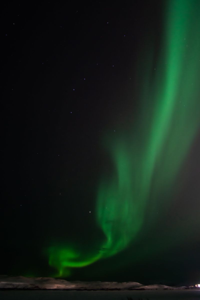
East of Selfoss the road crosses flat farmland with views of Hekla and the Eyjafjallajökull ice cap. Hella and Hvolsvöllur are small service towns and good bases with dark skies for the northern lights.
Which waterfalls are on the south coast?
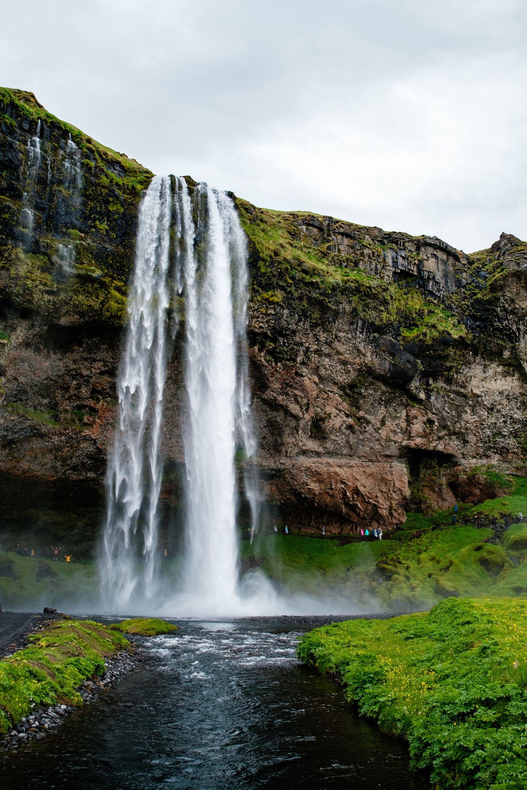
The two big ones are Seljalandsfoss and Skógafoss, both 60 metres high and both visible from Route 1. Plan at least an hour at each.
- Seljalandsfoss falls from an old sea cliff, and a path leads into a small cave behind the water. Expect to get wet, and take care on the slippery steps. A short walk along the cliff brings you to Gljúfrabúi, a waterfall hidden inside a narrow gorge.
- Skógafoss is 25 metres wide and throws up so much spray that rainbows are common on sunny days. A staircase of 527 steps climbs to a platform at the top, where the Fimmvörðuháls trail heads up between two glaciers towards Þórsmörk.
For more falls along this road, including Kvernufoss near Skógar, see our guide to south coast waterfalls.
Can you walk on a glacier on the south coast?
Yes, but only with a guide. Sólheimajökull, an outlet glacier of Mýrdalsjökull, is a short drive up a side road from Route 1. You can walk from the car park to look at the ash-striped ice front, and guided glacier hikes with crampons start from the same car park. Never walk onto the ice on your own.
Is the Sólheimasandur plane wreck worth it?
It depends on whether you enjoy long, flat walks. The wreck is a US Navy DC-3 that came down on the black sand in 1973; everyone on board survived. Cars have been banned from the track since 2016, so you walk about 3.5–4 km each way, which takes 45 minutes to an hour each way. A paid shuttle runs from the car park in summer. Please do not climb on the wreck.
What should you see around Vík?
Vík í Mýrdal is a village of about 740 people and the main base on this stretch, with hotels, a supermarket and fuel. Three sights sit within a few kilometres.
- Dyrhólaey. A headland about 120 metres high with a huge sea arch and a lighthouse from 1927. The turn-off is about 5 km west of Vík. Parts of it close in spring, roughly mid-May to late June, to protect nesting birds, and puffins nest in the cliffs from late April to mid-August.
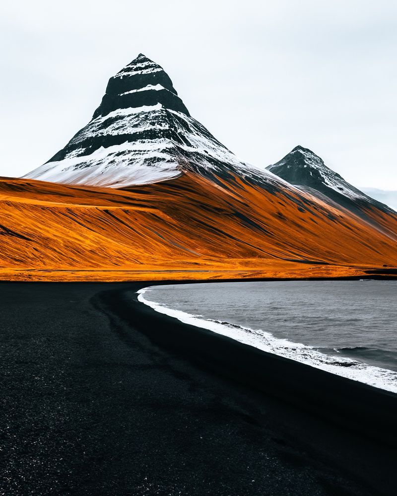
- Reynisfjara. The famous black beach with basalt columns, the Hálsanefshellir cave and the Reynisdrangar sea stacks. It has killed several visitors through sneaker waves. Follow the warning lights at the entrance and read our black sand beach safety guide first.
- Vík's own beach. The black beach in front of the village has views of the sea stacks from the other side. The same rules apply: stay well back from the waves.
Do not go near the water at Reynisfjara, even on calm days. On a red light, a gate closes the path down to the basalt columns and cave. Swimming is never safe on these beaches.
What is there between Vík and Skaftafell?
East of Vík the road crosses the black sands of Mýrdalssandur and then the Eldhraun lava field, covered in thick, soft moss. Do not walk on the moss: it is fragile and takes decades to recover.
Just before Kirkjubæjarklaustur, a short side road leads to Fjaðrárgljúfur, a winding canyon up to 100 metres deep and about 2 km long. A path follows the eastern rim to viewing platforms. It was closed for a time in 2019 when crowds threatened the path, so obey any closure signs.
Kirkjubæjarklaustur has fuel and a shop. After it, the road runs a long, empty stretch across the Skeiðarársandur outwash plain towards Skaftafell, so fill up before you go.
What can you do at Skaftafell?
Skaftafell is part of Vatnajökull National Park and the best place on the south coast to stretch your legs. The most popular trail climbs about 140 metres over 1.5 km to Svartifoss, a waterfall that falls over dark basalt columns. A longer circular route, about 5.8 km and two hours, continues to the Sjónarsker viewpoint and an old turf house at Sel.
Skaftafell is also a base for glacier hikes and, in winter, ice cave tours. The ice caves form only in the cold months and can only be visited with a licensed guide. See our ice cave guide.
How do you visit Jökulsárlón and Diamond Beach?
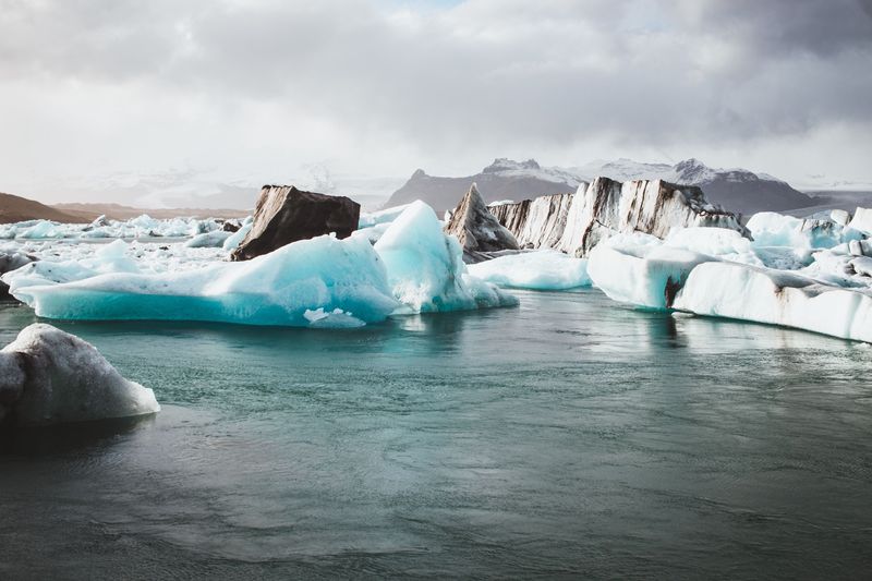
Jökulsárlón sits right beside Route 1, about 75 km west of Höfn. Icebergs break off Breiðamerkurjökull and drift across a lagoon that began forming in 1934–35 and is now up to 284 metres deep. Seals often swim between the icebergs, especially in winter.
Across the bridge, chunks of ice wash up on the black sand of Diamond Beach. Stay off the icebergs, on land and in the water, because they can roll. Ten minutes to the west, Fjallsárlón is a smaller lagoon where the glacier front reaches the water. Our Jökulsárlón and Diamond Beach guide covers boat tours and timing.
What is there to do in and around Höfn?
Höfn is a fishing town of about 1,800 people at the end of the south coast. It is known for its lobster, which is really langoustine, and holds a lobster festival on the first weekend of July. Höfn airport has scheduled flights to Reykjavík, which is useful if you do not want to drive back.
About 15 km east of town, a gravel road leads to Stokksnes and the jagged peaks of Vestrahorn above black dunes. The land is private, and you pay a small fee at the Viking Café.
How many days do you need for the south coast?
| Day | Route | Main stops | Sleep |
|---|---|---|---|
| 1 | Reykjavík to Vík | Seljalandsfoss, Gljúfrabúi, Skógafoss, Sólheimajökull, Dyrhólaey | Vík |
| 2 | Vík to the glaciers | Reynisfjara early, Fjaðrárgljúfur, Skaftafell and Svartifoss | Near Skaftafell |
| 3 | Glaciers to Höfn | Fjallsárlón, Jökulsárlón, Diamond Beach, Stokksnes | Höfn |
With one day only, turn back at Vík. With four days, add a glacier hike or a quieter morning at Skaftafell. Beds are scarce east of Vík, so read where to stay in Iceland and book early, especially for June to August.
What should you know before driving the south coast?
- Wind is the main hazard. The sands east of Vík are exposed, and strong gusts can close the road. Check vedur.is and road.is before each leg.
- Parking is often paid. Seljalandsfoss, Dyrhólaey and other busy sites charge for parking, usually through an app.
- Start early. Tour buses from Reykjavík reach Seljalandsfoss and Skógafoss from mid-morning.
- Never stop on the road for photos. Use the car parks and lay-bys.
Facts checked October 2026. Distances are approximate road distances on Route 1. Seasonal closures at Dyrhólaey, parking fees and conditions at Reynisfjara change; check signs on site and safetravel.is.