The Iceland Ring Road is Route 1, a paved road of about 1,322 km that circles the whole island and links most of its towns and famous sights. You need at least seven days to drive it, and ten to fourteen days if you want short driving days and time for detours. In summer an ordinary car is enough. In winter it is a serious drive that needs flexible plans. This guide covers the route, how long it takes, where to stop, the rules of the road and what changes with the seasons.
What is the Iceland Ring Road?
The Ring Road is Iceland's main highway, numbered Route 1, and it runs right around the country. Visit Iceland gives its length as 1,322 km. The Icelandic Road and Coastal Administration simply says "more than 1,300 km", because small realignments change the figure from year to year.
The loop was completed in 1974, when bridges across the Skeiðarársandur glacial plain in the south-east finally joined the northern and southern roads. The last gravel stretch was paved in 2019, so today the whole of Route 1 has a hard surface. Most of it is still a two-lane road with no hard shoulder, and it carries more than 2,000 vehicles a day on many sections in summer.
The road passes Reykjavík, Selfoss, Hella, Vík, Höfn, Egilsstaðir, the Mývatn area, Akureyri, Blönduós and Borgarnes. It skips two of the best regions in the country, the Snæfellsnes peninsula and the Westfjords, which you reach on side roads.
How many days do you need for the Ring Road?
Plan at least seven days for the Ring Road, and ten if you can. Without stops the loop is roughly 17 to 20 hours of driving, but nobody drives it that way. Every day you will stop at waterfalls, walk to viewpoints and wait out showers.
| Trip length | Driving per day | What it feels like |
|---|---|---|
| 5–6 days | 4–6 hours | Possible in summer, but mostly driving. Not recommended. |
| 7 days | 2–5 hours | The classic loop. Long days, the main sights only. |
| 10 days | 1–4 hours | Time for short hikes, a glacier walk and one or two detours. |
| 14 days | 1–3 hours | Adds Snæfellsnes or the Westfjords at an easy pace. |
Our 7-day Ring Road itinerary follows the fast loop day by day. The 10-day Ring Road itinerary is the slower version, with nights at Skaftafell and in the east. If you only have a few days, skip the full loop and use our 5-day Iceland itinerary or 3 days in Iceland plan instead.
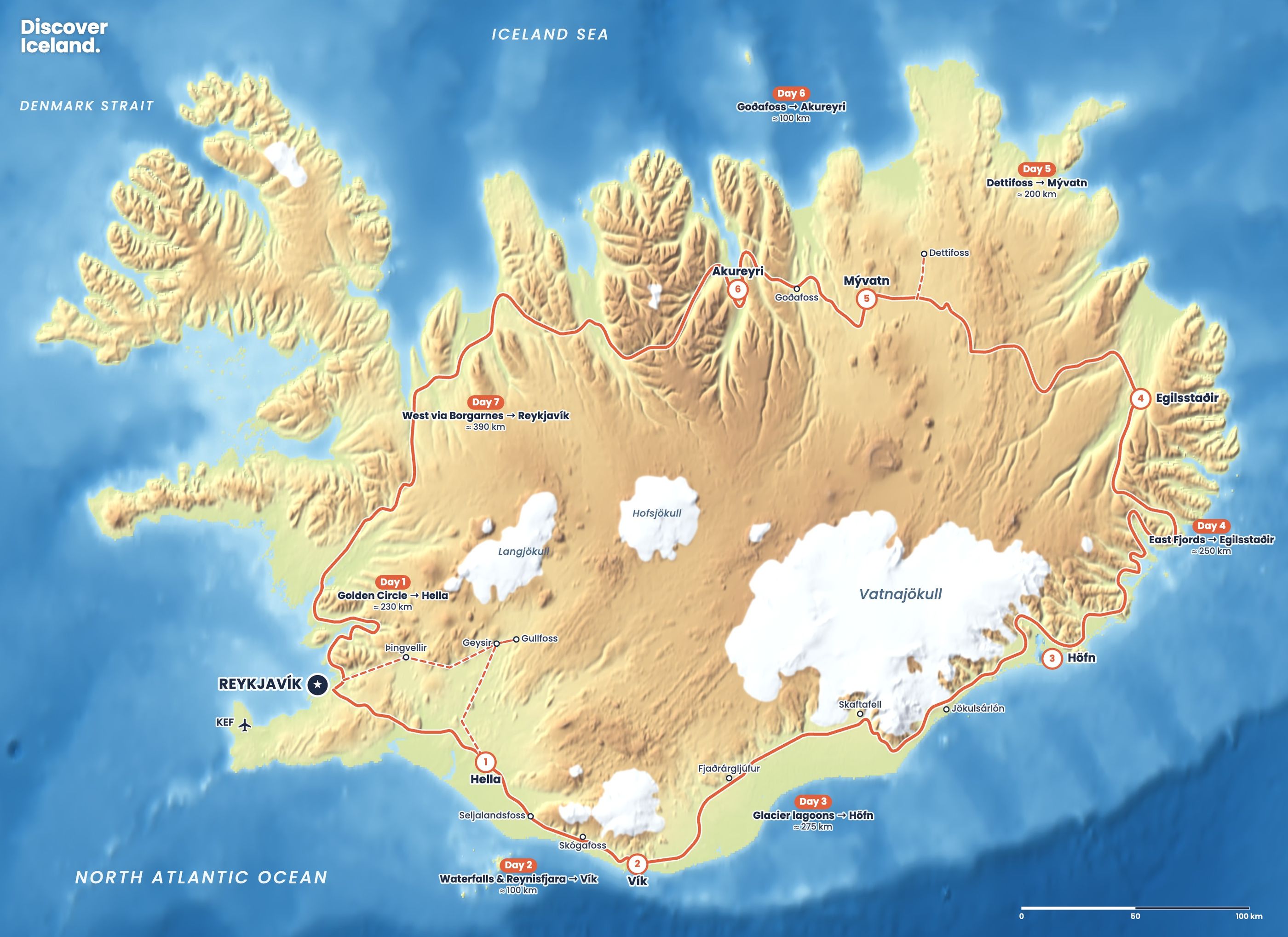
Which direction should you drive the Ring Road?
Most people drive anticlockwise, heading east along the south coast first. That puts the big sights, the Golden Circle, the south coast waterfalls and the glacier lagoons, at the start of the trip while you are fresh. It also means the remote east and north come in the middle, when you are used to the roads.
Driving clockwise works just as well and can be the better choice in late summer. You get the quieter north first and finish on the south coast, which usually has the most daylight and the mildest weather. In winter, decide on the day: start in whichever direction the forecast is better.
What are the best stops on the Ring Road?
The best stops on the Ring Road are spread evenly around the island. Here they are region by region, anticlockwise from Reykjavík.
Golden Circle and the south coast
- Þingvellir, Geysir and Gullfoss: the Golden Circle is a short loop off Route 1 and an easy first day.
- Seljalandsfoss and Skógafoss: two 60-metre waterfalls right beside the road. You can walk behind Seljalandsfoss, and 527 steps climb to the top of Skógafoss.
- Reynisfjara: the black sand beach and basalt columns near Vík. Stay well back from the water; the waves here are deadly.
The glacier coast
- Skaftafell: walking trails, Svartifoss and glacier views in Vatnajökull National Park.
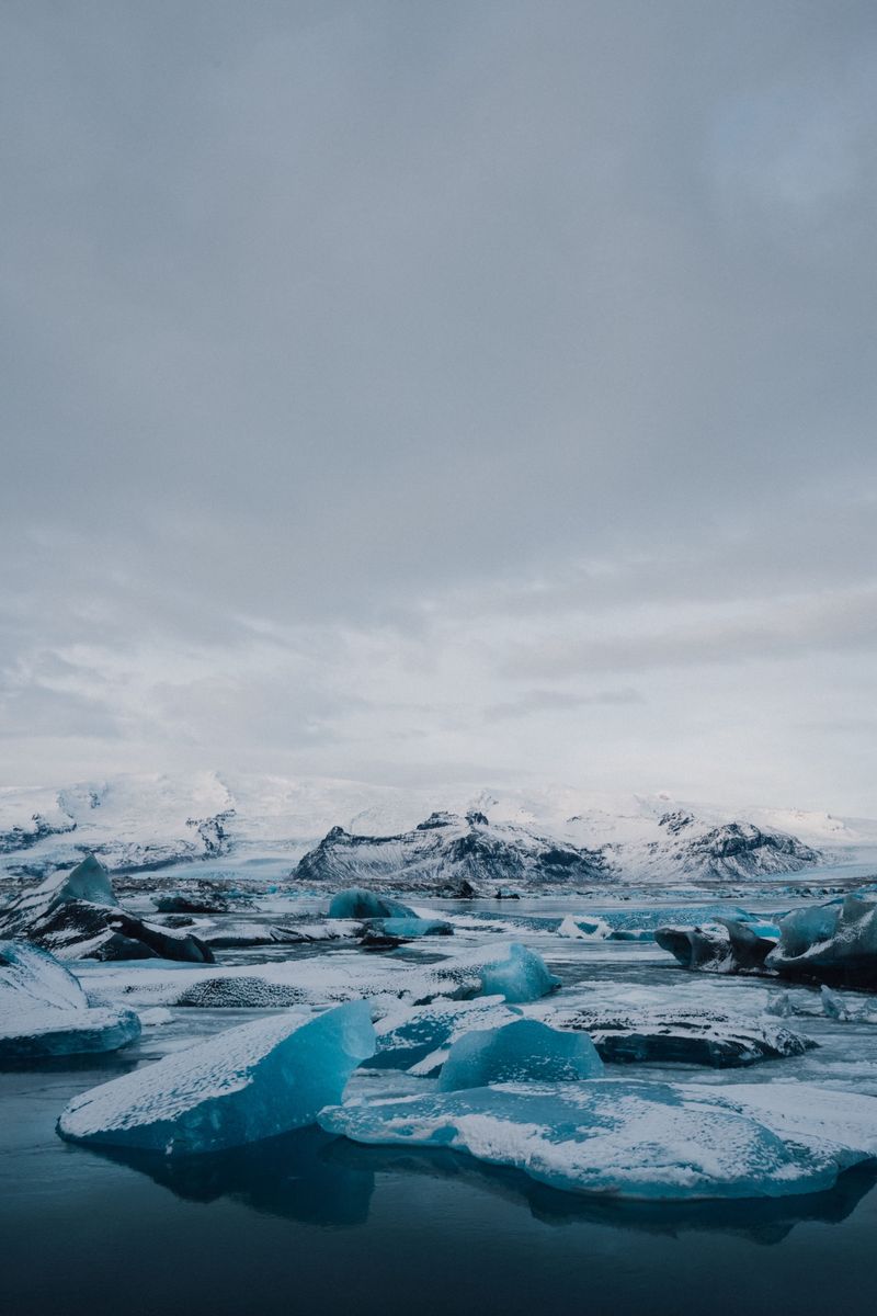
- Jökulsárlón and Fjallsárlón: glacier lagoons full of icebergs, with Diamond Beach across the road from Jökulsárlón.
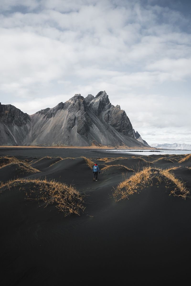
- Stokksnes and Vestrahorn: black dunes below jagged peaks, just before Höfn.
The East Fjords and the north
- The East Fjords road: fishing villages and empty bays between Höfn and Egilsstaðir.
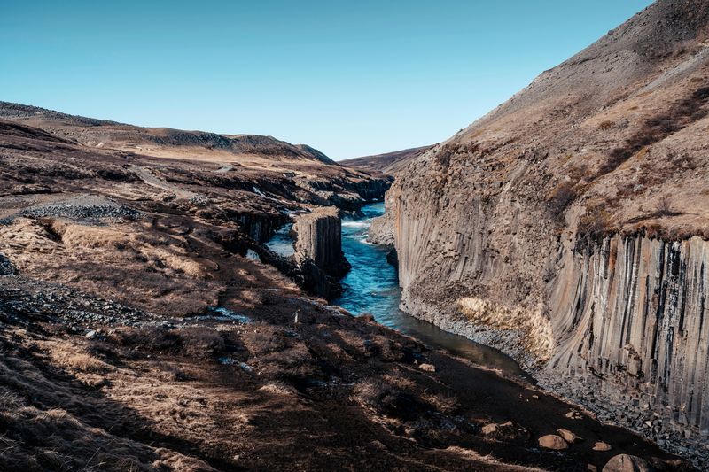
- Hengifoss and Stuðlagil: a 128-metre waterfall and a basalt canyon, both short detours from Egilsstaðir.
- Dettifoss, Mývatn and Goðafoss: a 44-metre waterfall 100 metres wide, a volcanic lake district, and the 12-metre Goðafoss right beside Route 1.
- Akureyri: the largest town on the Ring Road and a good place to rest for a night.
For every sight on one interactive map, see our Iceland highlights.
How long are the drives between the main stops?
The longest single legs are Vík to Höfn, Höfn to Egilsstaðir and Akureyri back to Reykjavík. These are rough distances and drive times without stops, in good summer conditions.
| Leg | Distance | Drive time |
|---|---|---|
| Reykjavík to Vík | about 185 km | about 2.5 h |
| Vík to Höfn | about 270 km | about 3.5 h |
| Höfn to Egilsstaðir (coast) | about 250 km | about 3.5–4 h |
| Egilsstaðir to Mývatn | about 165 km | about 2 h |
| Mývatn to Akureyri | about 90 km | about 1–1.5 h |
| Akureyri to Reykjavík | about 390 km | about 4.5–5 h |
For every leg stop by stop, plus the main detours, see our Ring Road driving times table.
What are the rules for driving the Ring Road?
The speed limit on the paved Ring Road is 90 km/h, dropping to 50 km/h or less in towns. Gravel roads off the Ring Road are 80 km/h. Speed cameras are common and fines are high.
- Headlights on, always. Icelandic law requires dipped headlights and tail lights day and night, all year.
- Single-lane bridges. The first car to reach the bridge has priority. SafeTravel advises slowing to 50 km/h and stopping for oncoming traffic. As of 2023 there were 29 single-lane bridges on Route 1, down from 140 in 1990, and the road authority aims to replace the rest before 2039.
- No stopping on the road. Pull into a proper car park or lay-by for photos. Stopping on the carriageway causes accidents every year.
- No off-road driving. Leaving the road damages moss and soil for decades and is illegal.
- No phones. Using a phone while driving is illegal.
- Seatbelts for everyone, and child seats for children under 135 cm.
Is the Ring Road safe to drive?
Yes, the Ring Road is safe in summer for any confident driver, and in winter for drivers who respect the weather. The road authority warns that rental-car drivers and people unused to Icelandic roads have a higher risk of accidents, so the main danger is unfamiliarity, not the road itself.
The typical hazards are easy to plan for. Blind summits and sharp bends appear on older stretches. Sheep wander onto the road in summer. Gravel shoulders are soft, and the change from tarmac to gravel catches people out. Wind is the biggest surprise: strong gusts can push a car sideways and tear a door from its hinges. Do not drive tired; switch drivers or stop for a rest, and avoid long days at the wheel. Carry water, food and warm clothes, because help can be far away in remote areas.
Do you need a 4x4 for the Ring Road?
No. The whole of Route 1 is paved, and a two-wheel-drive car is fine in summer. Guide to Iceland recommends a 4x4 between October and May, when snow and ice are likely. A 4x4 is also needed if you want to leave the Ring Road for the highland F-roads, which only open in summer and where normal cars are not allowed.
Many sights sit a short way off Route 1 on gravel roads. Slow down as you move from tarmac to gravel, because grip changes suddenly. Rental contracts often exclude gravel damage, so read the insurance terms before you choose a car.
Are there tolls on the Ring Road?
There is one toll, at the Vaðlaheiðargöng tunnel just east of Akureyri. The fee for a car was ISK 2,216 per trip when we checked in 2026. There are no booths: cameras read your plate and you pay online at veggjald.is within 24 hours before or after you drive through. If you do not pay, the bill goes to the rental company, which usually adds a fee.
The Hvalfjörður tunnel north of Reykjavík has been free since September 2018. Several popular sights charge for parking, including Þingvellir, where a car with up to five seats pays ISK 1,000 for the day.
Where can you get fuel on the Ring Road?
Fuel stations are frequent in the south-west and around Akureyri, but gaps open up in the east. Between Höfn and Egilsstaðir and on the high plateau east of Mývatn, keep the tank above half and fill up whenever you can. Many pumps are self-service and card-only, so carry a payment card that works abroad.
Electric cars are workable on the Ring Road in summer, with fast chargers along the route, but plan each charge in advance in the east and north.
What is the best time of year to drive the Ring Road?
June to August is the easiest time to drive the Ring Road. The days are long, the mountain passes are clear and every side road is open. It is also the busiest time: Visit Iceland notes that rooms between Selfoss and Höfn fill up in peak summer, and traffic between Reykjavík and Akureyri can be heavy in July. May and September are a good balance, with fewer people and usually dry roads.
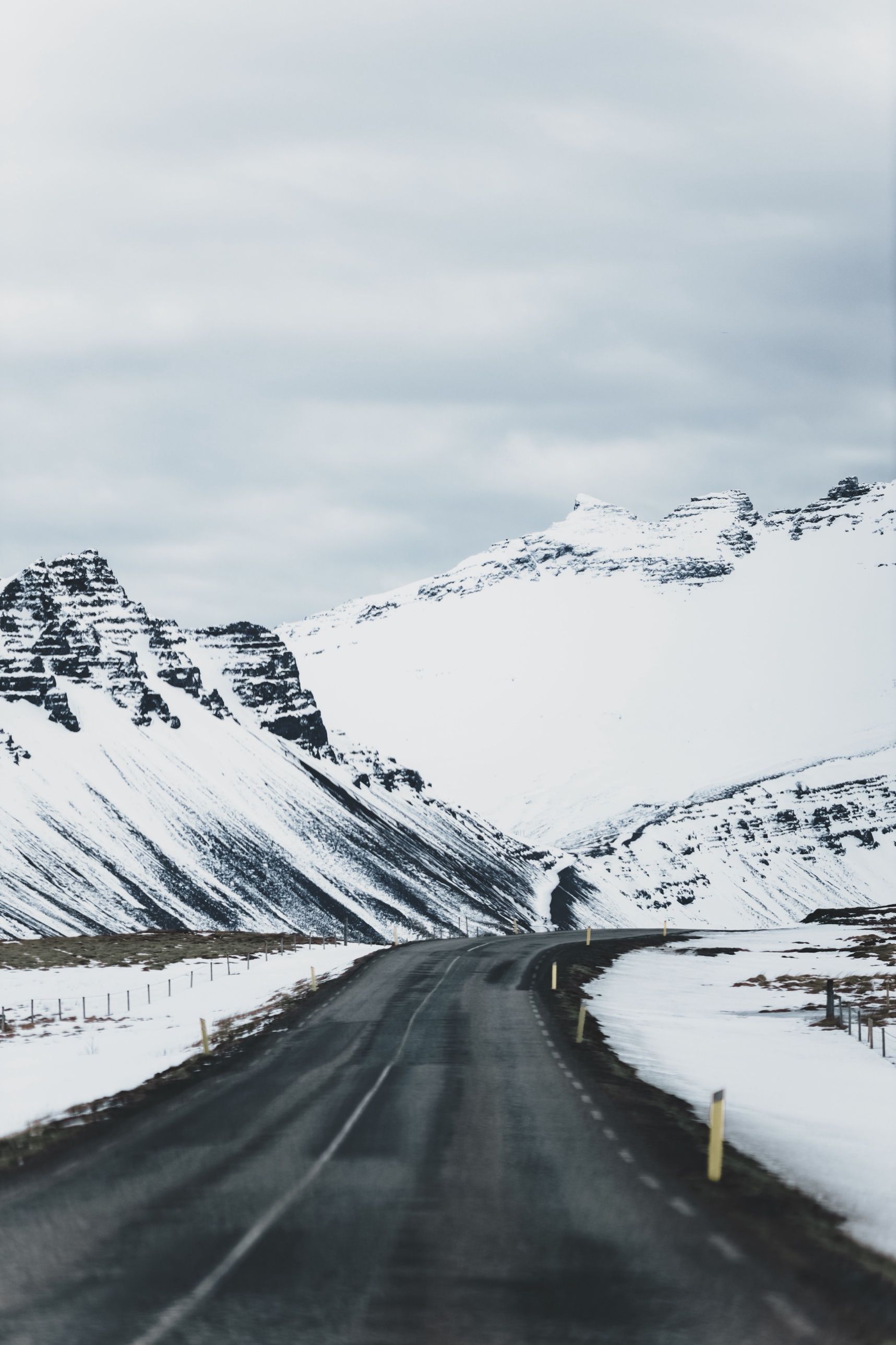
From September to May, watch the mountain passes. Visit Iceland names Holtavörðuheiði, Öxnadalsheiði and Möðrudalsöræfi as the stretches that most often close in storms or high wind. Our full guide to the Ring Road in winter covers tyres, daylight and closures. For month-by-month weather, see the best time to visit Iceland.
Autumn and winter add one big reward. From late August to April the nights are dark enough for the northern lights, and the countryside along Route 1, far from town lights, is an ideal place to watch them on a clear night. Never stop on the road to look; pull fully into a car park first. Our northern lights guide explains the forecasts.
Every morning: check the road map at road.is (or call 1777), the forecast and wind warnings at vedur.is, and alerts on SafeTravel. Check again during the day. Conditions can change within hours.
What detours are worth adding to the Ring Road?
The most rewarding detours are the ones Route 1 leaves out. With extra days, consider these:
- Snæfellsnes: Kirkjufell, lava fields and the 1,446-metre Snæfellsjökull, about two to two and a half hours from Reykjavík. It fits well on the last day or two.
- The Westfjords: the region the Ring Road skips entirely, with Dynjandi, Látrabjarg and quiet fjord roads. It needs four days or more; see our Westfjords road trip.
- Seyðisfjörður: a small fjord town over a mountain pass from Egilsstaðir.
- Húsavík: about an hour from Akureyri, known for whale watching.
- Öxi pass (Route 939): a 19 km gravel shortcut that cuts about 70 km off the drive from Djúpivogur to Egilsstaðir. It is steep and narrow, closed in winter, and best avoided in fog.
Can you do the Ring Road without a car?
It is possible, but hard. Rural buses link many towns along Route 1, but some run only a few times a day and they do not stop at most sights. You would spend days waiting and still miss the waterfalls and lagoons between towns.
The realistic alternatives are a guided multi-day Ring Road tour, or a mix of day tours from Reykjavík and a domestic flight to Akureyri or Egilsstaðir.
Where should you stay along the Ring Road?
Stay somewhere new every one or two nights. The classic overnight stops are Hella or Selfoss, Vík, the Skaftafell area or Höfn, Egilsstaðir, Mývatn and Akureyri. Book the stretch from Vík to Höfn first, because there are few beds and they go early. Campervans must use campsites, not lay-bys. Our guide to where to stay in Iceland compares each base.
How much does it cost to drive the Ring Road?
Car hire and rooms are the big costs, and both depend heavily on season and how early you book. A compact car in winter and a 4x4 or campervan in July can differ several times over in price, so compare quotes for your exact dates. Then budget for fuel, which is expensive in Iceland, plus the tunnel toll and parking fees.
You can save by cooking some meals, using campsites in summer and swimming in the local geothermal pools rather than the big lagoons. For everything else about cars, buses and flights, see getting around Iceland.
What should you pack for a Ring Road trip?
- Waterproof jacket and trousers, warm layers, hat and gloves, in every season.
- Walking boots with good grip, and ice cleats from October to April.
- A swimsuit and towel for the town pools.
- Offline maps on your phone, because signal drops in the east and north.
- Snacks and water for the long empty stretches, and a phone charger for the car.
Before you go, leave a travel plan on SafeTravel and save 112, the emergency number. If you want everything in one place on the road, our printed Complete Guide to Iceland covers the Ring Road region by region.
Facts checked October 2026. Road lengths, single-lane bridge counts, the Vaðlaheiðargöng toll and parking fees change; check road.is, veggjald.is and each site's own page before you travel, and check road and weather conditions every day.
Sources
- The Ring Road – Route Number One (Visit Iceland)
- The Ring Road (Icelandic Road and Coastal Administration)
- Route 1 (Iceland) (Wikipedia)
- Ring Road travel guide (Guide to Iceland)
- Top 12 tips for driving in Iceland (SafeTravel)
- Vaðlaheiðargöng tunnel toll (Go Car Rental)
- How long to drive around Iceland (Blue Car Rental)
- Parking service (Þingvellir National Park)