North Iceland is the region around Akureyri, Lake Mývatn and Húsavík, and it has some of the country's most powerful sights: Dettifoss, Goðafoss, the volcanic landscapes of Mývatn and whales in Skjálfandi Bay. Most of them sit on the Diamond Circle, a 250 km loop that is paved all the way. This guide covers where to base yourself, what to see and how many days to give it.
Where is North Iceland, and how do you get there?
North Iceland runs from the Tröllaskagi peninsula east to the plateaus beyond Mývatn. Akureyri, its main town, is about 390 km from Reykjavík by the Ring Road, or a flight of under an hour from Reykjavík's city airport. Flying in and renting a car in Akureyri is a good way to see the north on a short trip, particularly in winter. Our guide to getting around Iceland compares the options.
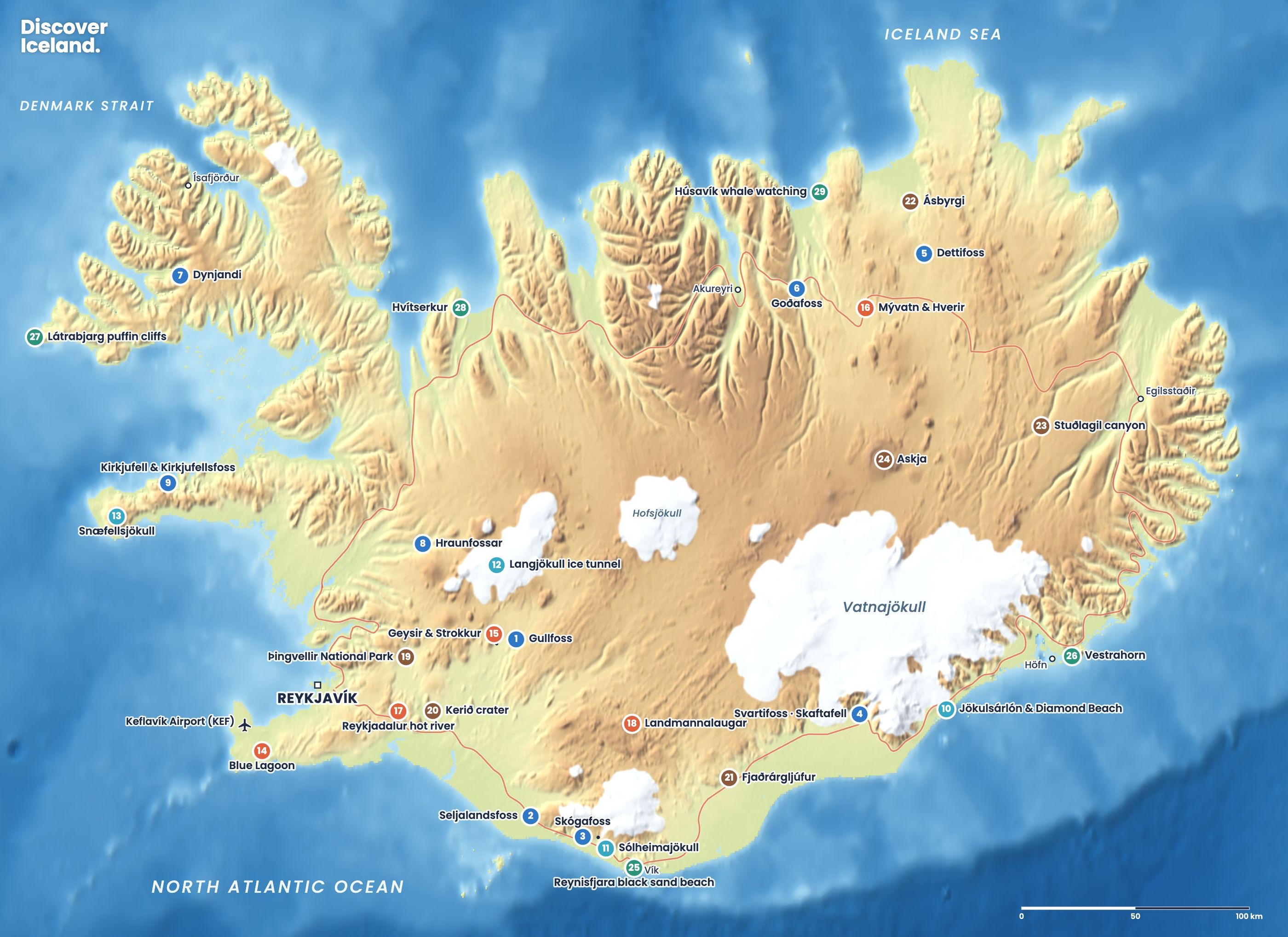
If you are driving the full Ring Road, the north usually comes after the East Fjords and Stuðlagil canyon. It is one of the regions in our overview of things to do in Iceland, and every sight below is also on our interactive highlights map.
Is Akureyri worth visiting?
Yes. Akureyri is Iceland's largest town outside the capital area, with about 20,000 people, at the head of the long Eyjafjörður fjord. It sits about 100 km south of the Arctic Circle. It has hotels, restaurants, a good swimming pool and a botanical garden where plants grow outdoors thanks to the town's sheltered climate.
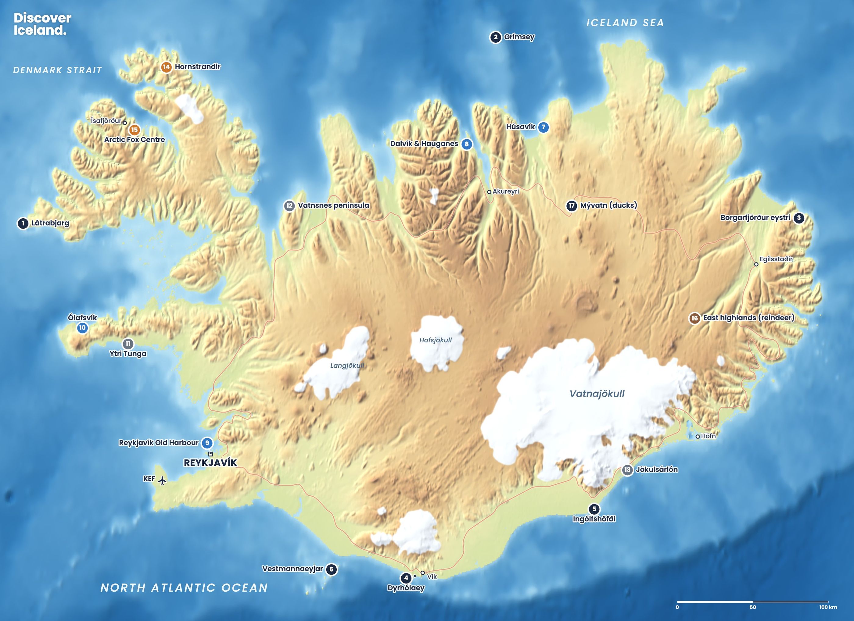
It is the most comfortable base in the north, especially in winter. Whale-watching boats leave from its harbour, a few minutes' walk from the centre, on tours of about two to two and a half hours. From Dalvík, 45 km to the north, a ferry sails year round to Grímsey, the island on the Arctic Circle, in about three hours each way.
What is the Diamond Circle?
The Diamond Circle is a 250 km loop in North Iceland that links five main sights: Goðafoss, Lake Mývatn, Dettifoss, Ásbyrgi canyon and Húsavík. It became fully paved in 2020. It can be driven in a day, but two days is far better. From October to April snow and ice are common, so a 4x4 is recommended and you should check conditions every morning.
| Stop | What it is | Allow |
|---|---|---|
| Goðafoss | 12 m high, 30 m wide waterfall on the Ring Road | 30–45 min |
| Lake Mývatn | Craters, lava formations, geothermal fields, lagoon | Half to full day |
| Dettifoss and Selfoss | 44 m waterfall and its wide neighbour upstream | 1–2 h |
| Ásbyrgi | Horseshoe canyon with walls up to 100 m | 1–2 h |
| Húsavík | Harbour town and whale-watching base | Half day with a tour |
How do you visit Goðafoss?
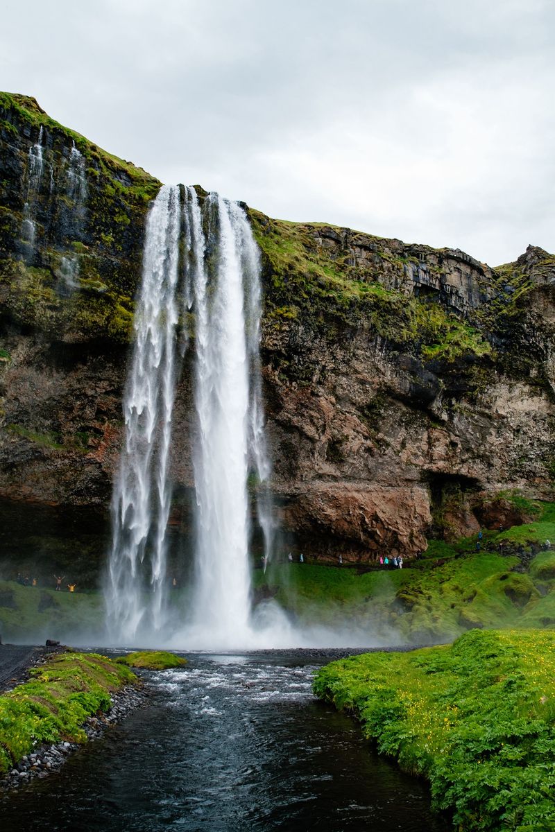
Goðafoss is right on the Ring Road, about 45 minutes east of Akureyri and roughly halfway to Mývatn. The Skjálfandafljót river falls 12 metres in a horseshoe about 30 metres wide. Paths and viewpoints run along both banks. According to a well-known story, a chieftain threw his statues of the Norse gods into the falls when Iceland adopted Christianity around the year 1000, though historians think that tale was added much later.
Between Akureyri and Goðafoss, the Vaðlaheiðargöng tunnel saves about half an hour. It is 7.4 km long and charges a toll for each crossing.
What is there to do at Lake Mývatn?
Mývatn is a shallow lake in a volcanic landscape, about 90 km and an hour's drive from Akureyri through the tunnel. You can easily spend a full day here.
- Skútustaðagígar: pseudocraters on the south shore, formed when lava flowed over wet ground. A short loop path circles them.
- Dimmuborgir: a maze of lava pillars and arches with marked walking trails.
- Hverfjall: a huge explosion crater about 1 km across and 140 metres deep. The walk up to the rim takes about 20 minutes.
- Hverir: a geothermal field below Námafjall, east of the lake, with steaming vents and boiling mud pots. Stay strictly on the paths: the crust can be thin over boiling water.
- Krafla and Víti: a volcanic area north of Hverir. Víti is an explosion crater about 300 metres across that formed at the start of the Mývatn Fires in 1724.
- Earth Lagoon Mývatn: the lagoon formerly known as Mývatn Nature Baths reopened in a new building in summer 2026. Read our Mývatn lagoon guide.
The lake is also one of Iceland's best places to watch ducks and other birds, especially in summer.
Which side of Dettifoss should you visit?
For most people, the west side. Dettifoss drops 44 metres over a 100-metre-wide edge into the Jökulsárgljúfur canyon, and it is one of the most powerful waterfalls in Europe. Paved Route 862 reaches the west bank and is open for most of the year. Gravel Route 864 reaches the east bank and is usually only passable in summer. The wide Selfoss waterfall is a few hundred metres upstream, and you can walk to it from the Dettifoss car park.
The viewpoints are close to the edge and spray makes the rock slippery. Our Dettifoss east or west guide compares both sides, and our waterfalls guide covers the other big falls.
What is Ásbyrgi?
Ásbyrgi is a horseshoe-shaped canyon about 3.5 km long and over 1 km wide, with cliffs up to 100 metres high. It is part of Vatnajökull National Park, and its floor is covered in birch woodland. Geologists believe huge glacial floods carved it; local legend says it is the hoofprint of Sleipnir, Odin's eight-legged horse.
South of Ásbyrgi, the Vesturdalur valley has the Hljóðaklettar rock formations, with walking paths among twisted basalt columns beside the river.
How good is whale watching in Húsavík?
Húsavík is known as the whale-watching capital of Iceland. Humpback and minke whales feed in Skjálfandi Bay from about March to November, with the peak from May to September. White-beaked dolphins and harbour porpoises are common, and blue whales appear occasionally in spring or early summer. One local operator reports seeing whales on 97% of its tours since 1995, but no sighting is ever guaranteed.
Húsavík itself is a small harbour town of about 2,400 people. Puffins nest on the small island of Lundey in the bay in summer.
How many days do you need in North Iceland?
Plan at least two full days, and three if you want a whale tour and time at Mývatn.
- Day 1: Akureyri to Mývatn via Goðafoss. Afternoon at Skútustaðagígar, Dimmuborgir and Hverfjall; evening at the lagoon.
- Day 2: Hverir and Krafla in the morning, then Dettifoss and Selfoss, Ásbyrgi and Hljóðaklettar. Sleep in Húsavík.
- Day 3: Morning whale watching from Húsavík, then back to Akureyri.
Add a day for Hvítserkur and the Vatnsnes peninsula on the way west towards Reykjavík.
When is the best time to visit North Iceland?
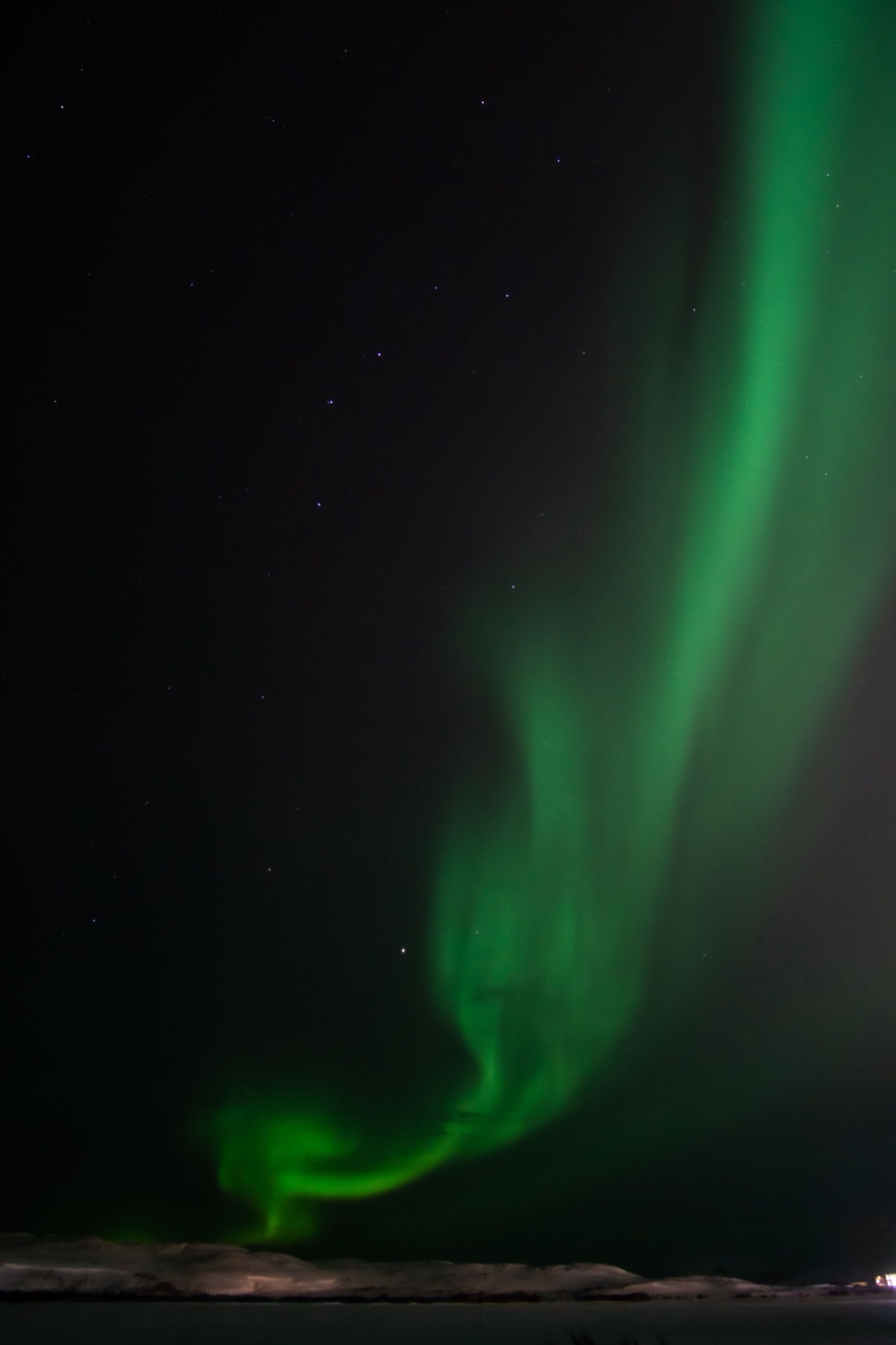
Summer, from June to August, gives the easiest roads, whale watching and very long days. The north is also a strong winter destination, with snowy landscapes and long dark nights for the northern lights. In winter, roads such as Route 864 close, and storms can close mountain passes on the Ring Road, so keep your plans flexible. Our best time to visit guide covers each month.
Before every drive in the north, check road.is for road status and vedur.is for wind and snow. Conditions on the passes near Mývatn can change within hours from autumn to spring.
Facts checked October 2026. Earth Lagoon Mývatn reopened in a new building in summer 2026; check its hours. Tunnel tolls, tour times and winter road openings change, so check before you travel.