The Snæfellsnes peninsula is often called Iceland in miniature, because one loop of about a day takes in a glacier-capped volcano, black beaches, lava fields, sea cliffs, fishing villages and Kirkjufell, the country's most photographed mountain. It starts about 145 km from Reykjavík, so you can see the highlights on a long day trip or, better, with one or two nights on the peninsula. Here is the route, stop by stop.
Where is Snæfellsnes, and how long does it take to get there?
Snæfellsnes is the long arm of land about 90 km long in West Iceland, north of Reykjavík. The drive from the capital takes about two to three hours on Routes 1 and 54, through Borgarnes. The full coastal loop takes four to five hours of driving without stops, so a day trip from Reykjavík is long but possible in summer.
In winter, with only a few hours of daylight, spend at least one night. Stykkishólmur, the largest town on the peninsula, and Grundarfjörður, beside Kirkjufell, are the main bases. Our guide to where to stay in Iceland compares them, and the peninsula features in our overview of things to do in Iceland.
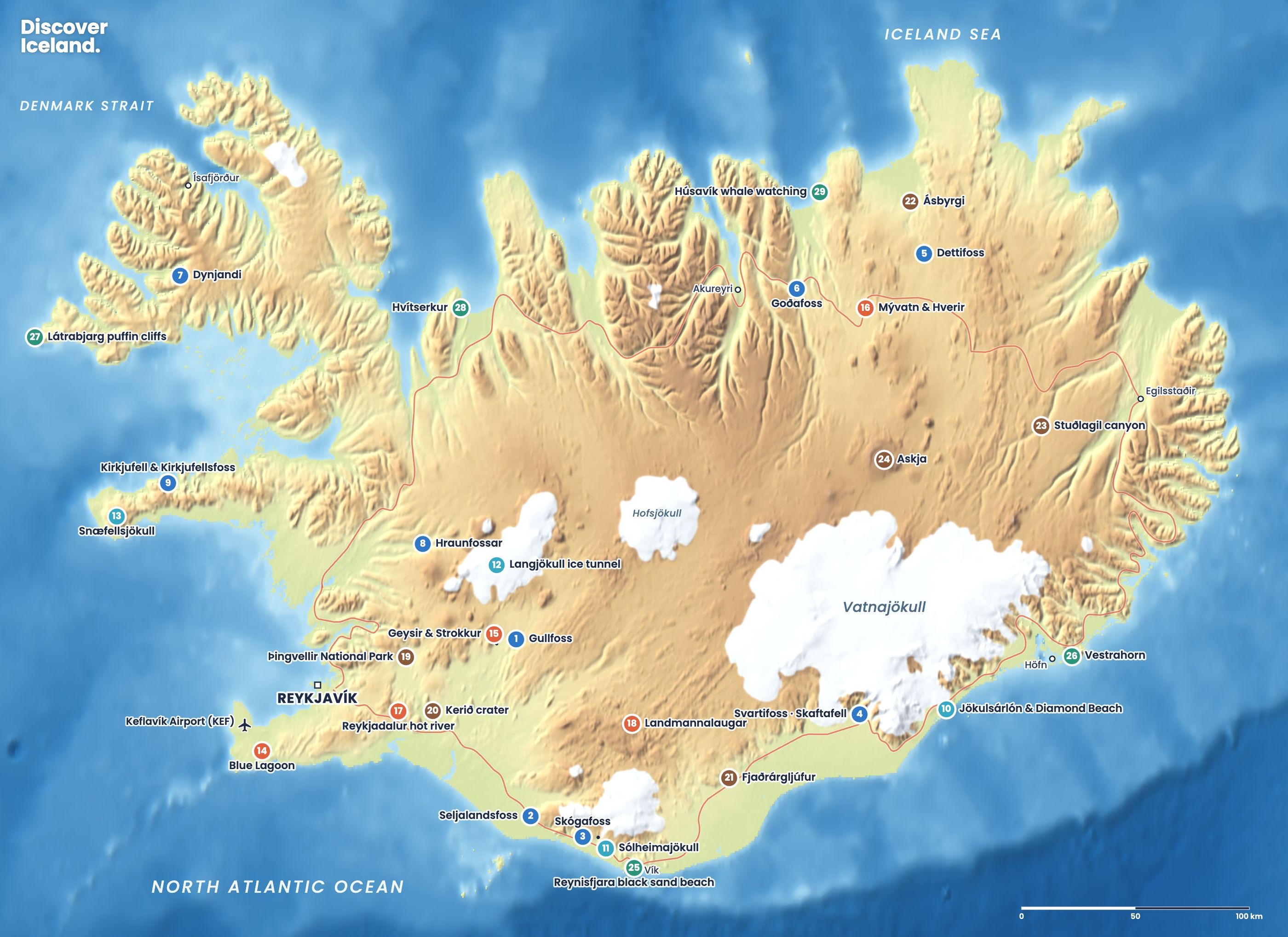
What is the best route around Snæfellsnes in one day?
Drive the loop clockwise: west along the south coast, round the tip of the peninsula past the glacier, then east along the north coast to Kirkjufell. That puts the most famous view near the end of the day, often in good evening light in summer.
- Gerðuberg: a wall of hexagonal basalt columns about 1 km long, a short way off Route 54.
- Ytri Tunga: a rare golden-sand beach where seals rest on the rocks, best in summer and at low tide.
- Búðir: a lone black church in a lava field by the sea.
- Arnarstapi and Hellnar: a 2.5 km clifftop path between two old fishing villages.
- Snæfellsjökull National Park: Lóndrangar, Djúpalónssandur, Vatnshellir and Saxhóll.
- The north coast: Ólafsvík and Grundarfjörður.
- Kirkjufell and Kirkjufellsfoss.
- Stykkishólmur: the harbour town, if you are staying the night.
What is there to see on the south side of the peninsula?
The south coast of Snæfellsnes is flat farmland and lava along the shore, with the glacier ahead of you.
At Ytri Tunga, seals often haul out on the rocks 50–100 metres from the beach. Summer is the best time, with pups in June and July. Keep your distance, at least 50 metres from adults and 100 metres from pups, and keep dogs on a lead.
At Arnarstapi, a stone monument to Bárður Snæfellsáss, the half-troll guardian of the glacier in a 14th-century saga, stands near the cliffs. From here a coastal path of about 2.5 km leads past basalt cliffs, sea arches such as Gatklettur and nesting Arctic terns to the hamlet of Hellnar. Terns dive at walkers' heads in summer, so a hat helps.
Just east of Arnarstapi, Rauðfeldsgjá is a narrow gorge cut into the mountainside, with a stream and a small waterfall inside. The rocks are wet and slippery; go only as far as feels safe.
What can you see in Snæfellsjökull National Park?
Snæfellsjökull National Park was founded on 28 June 2001 and was the first national park in Iceland to reach from the mountains down to the sea. It covers about 170 km² around Snæfellsjökull, a 1,446-metre volcano under a glacier. The park has information centres at Malarrif and Hellissandur.
- Lóndrangar: two basalt pillars on the coast, the remains of an old crater, with a short path to a viewpoint.
- Djúpalónssandur: a black pebble beach reached by a path through lava. Four old lifting stones lie by the path, from 23 kg to 154 kg, once used to test the strength of fishermen. Rusty pieces of the British trawler Epine GY7, wrecked in 1948, lie on the beach. Swimming is prohibited because of dangerous waves and currents.
- Vatnshellir: a lava tube about 8,000 years old that reaches about 35 metres below ground. It can only be visited on a guided tour of about 50 minutes.
- Saxhóll: a crater with a staircase to the rim, about five minutes' climb, and a wide view over the lava fields.
Our guide to black sand beaches in Iceland explains how to stay safe on beaches like Djúpalónssandur, where waves can surge far up the shore.
How do you visit Kirkjufell?
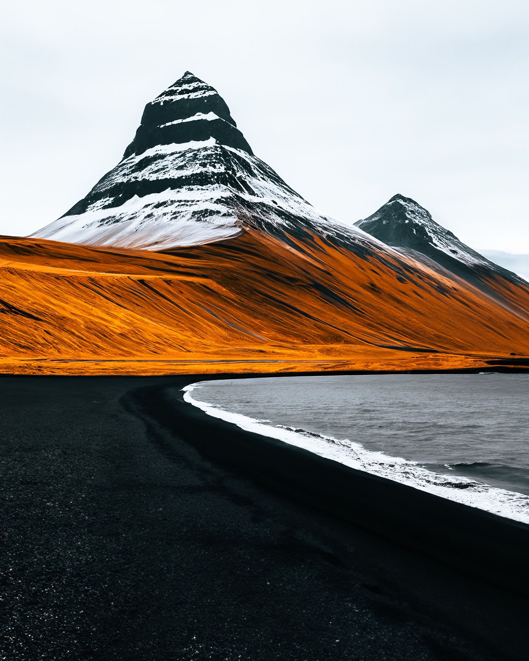
Most people photograph Kirkjufell from the small car park by Kirkjufellsfoss, just west of Grundarfjörður. A short path crosses the river above the waterfall, which frames the 463-metre mountain behind it. The view appeared in Game of Thrones, and it is especially popular for sunsets and, in winter, the northern lights.
Climbing Kirkjufell is a different matter. The steep upper sections become dangerous when wet, and there have been fatal falls, including in 2017, 2018 and 2022. Enjoy it from below unless you go with an experienced local guide in good conditions.
Park only in the marked car park at Kirkjufellsfoss and never on the road shoulder. It fills quickly at sunset, so arrive early or come back in the morning.
Is Stykkishólmur worth a visit?
Yes, especially as a base. Stykkishólmur is the largest town on Snæfellsnes, with about 1,200 people, colourful old houses around a harbour and a small hill with views over the islands of Breiðafjörður. The Baldur ferry sails from here across the bay to the Westfjords, which makes it a handy link if you are continuing on a Westfjords road trip.
Can you see whales and seals on Snæfellsnes?
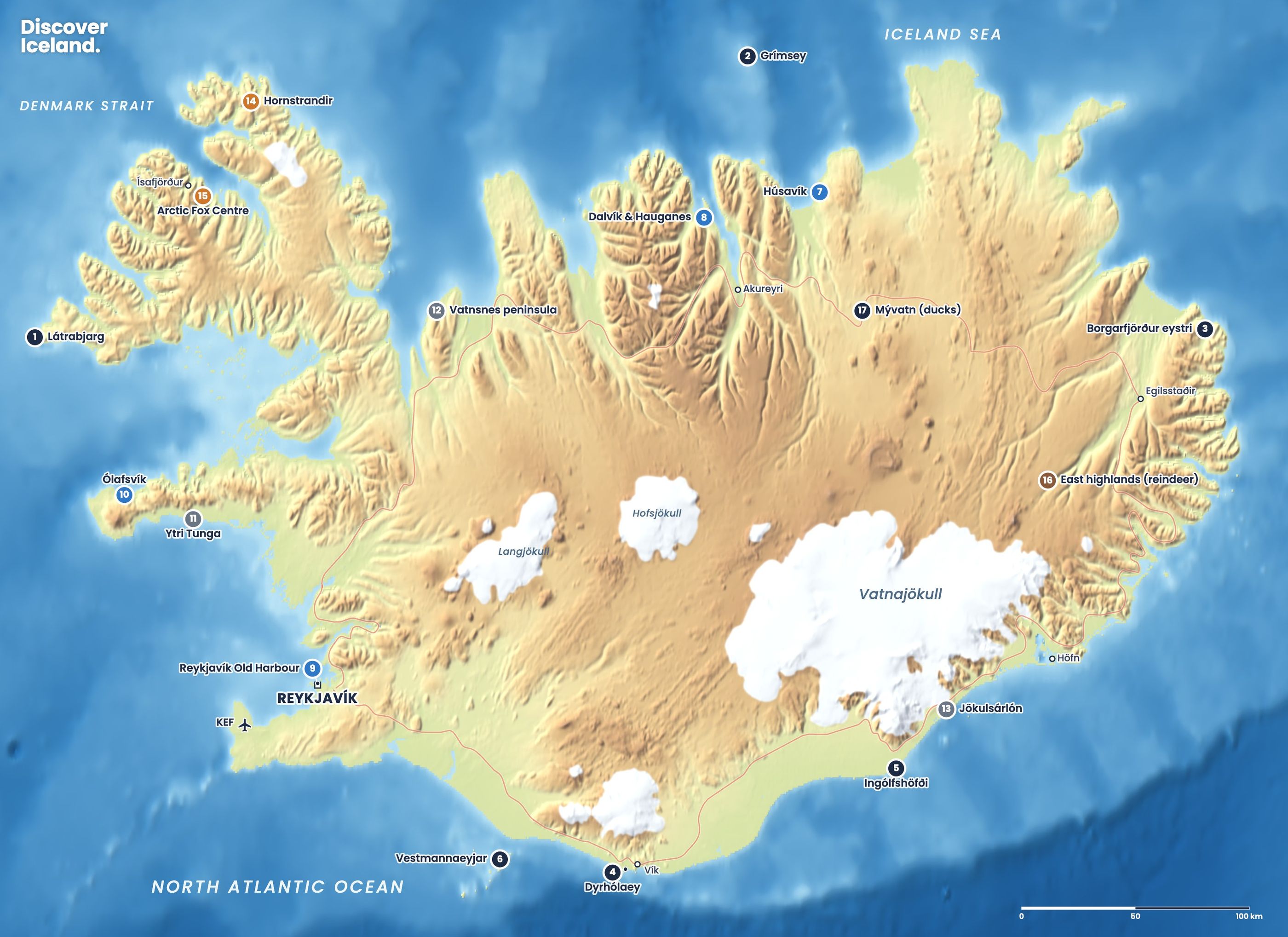
Seals, yes: Ytri Tunga is one of the easiest places in Iceland to see them. Our wildlife map also marks Ólafsvík on the north coast for whales. Wildlife is never guaranteed, so take any sighting as a bonus.
What should you know before driving around Snæfellsnes?
- Fill up in Borgarnes. It is the last town with a full range of shops and fuel before the peninsula.
- Check the roads in winter. Mountain roads across the peninsula and Route 574 around the glacier can be icy or closed in storms. Use road.is and vedur.is.
- Allow time. Stops add up quickly. A summer day trip from Reykjavík easily runs to 12 hours.
- Stay off the moss and lava. Use the marked paths at every stop.
For more on the peninsula's sights, see our Snæfellsnes place page, or browse all of Iceland's highlights on the highlights map. If Snæfellsnes leaves you wanting more of the west and north, our guide to Iceland's regions suggests where to go next.
Facts checked October 2026. Tour times for Vatnshellir, ferry timetables and winter road conditions change; check operators' websites and road.is before you go.