Iceland's regions are very different from each other. The south has the famous waterfalls, black beaches and glacier lagoons; the north has Mývatn, Dettifoss and whales; the east and Westfjords have quiet fjords; the highlands, open only in summer, have the wildest landscapes. This guide explains each region, what it is best for, and how to choose between them for the time you have.
What are the regions of Iceland?
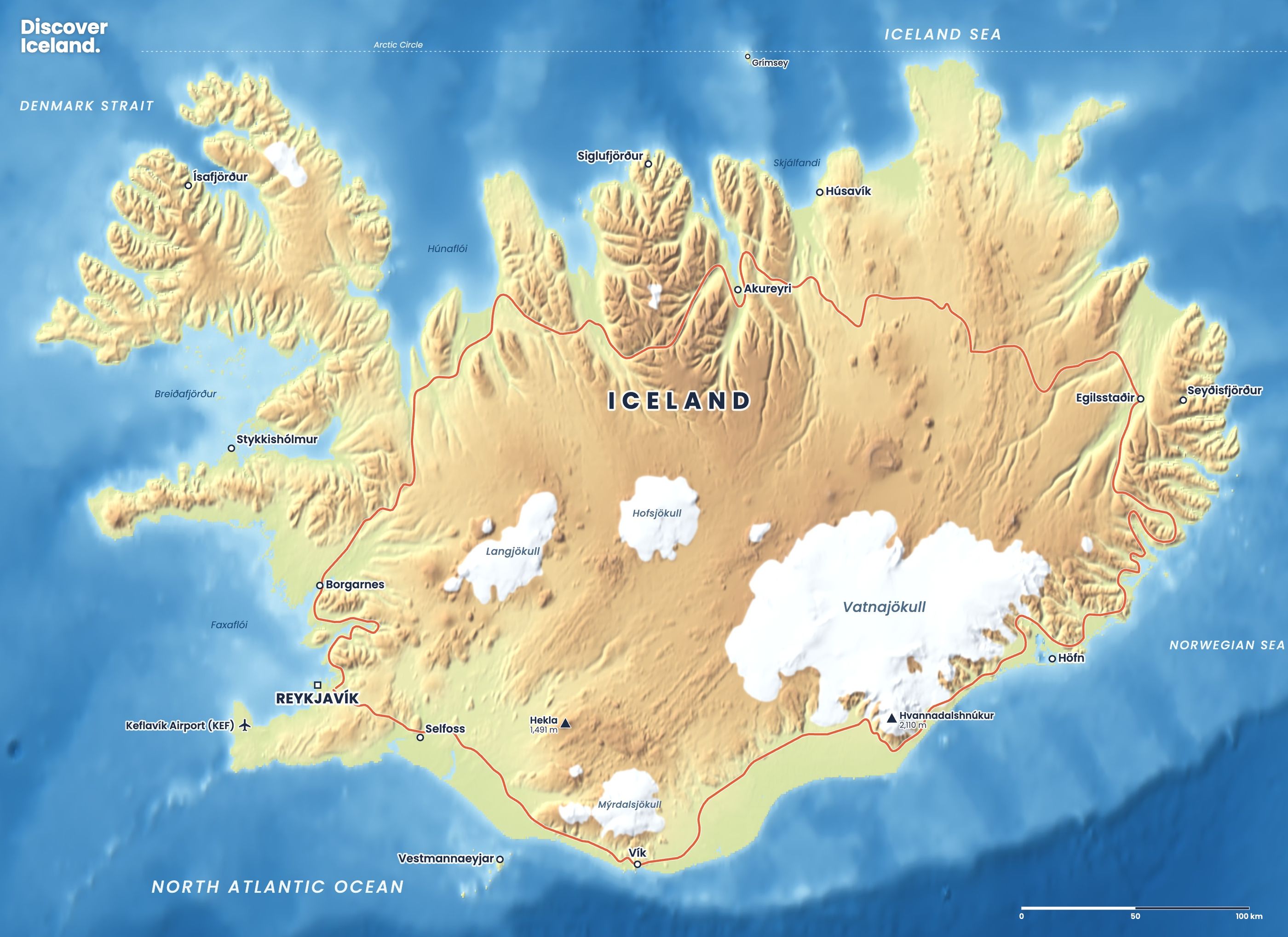
Officially, Iceland has eight regions. For travel, the tourist board groups the country into seven: Reykjavík and the capital area, Reykjanes, West Iceland, the Westfjords, North Iceland, East Iceland and South Iceland. Most travellers add an eighth, the uninhabited highlands, which cover about half the country and are not part of any town's daily life.
Iceland is about 103,000 km², but only about 390,000 people live here, and nearly two-thirds of them in the capital region. Outside it, towns are small and far apart.
How do Iceland's regions compare?
| Region | Main town | Best for | Best time |
|---|---|---|---|
| Reykjavík and capital area | Reykjavík | City life, pools, day tours | All year |
| Reykjanes | Reykjanesbær | Airport, lagoons, lava fields | All year |
| South Iceland | Selfoss | Golden Circle, waterfalls, beaches, glaciers | All year |
| West Iceland | Akranes | Snæfellsnes, Kirkjufell, lava caves | All year |
| Westfjords | Ísafjörður | Remote fjords, bird cliffs, solitude | June–September |
| North Iceland | Akureyri | Mývatn, Dettifoss, whales | All year |
| East Iceland | Egilsstaðir | Fjords, canyons, puffins, quiet roads | May–September best |
| Highlands | None | Landmannalaugar, Askja, hiking | About late June–September |
What is Reykjavík and the capital area best for?
Reykjavík is the base for a first trip, a short break or a winter visit without a car. It has most of the hotels and restaurants, a geothermal pool in every neighbourhood and almost every day tour picks up here. Þingvellir is about 40 km away, so the Golden Circle is an easy day out. See our Reykjavík place guide.
What is the Reykjanes peninsula like?
Reykjanes is where you land: Keflavík Airport sits on it. It is a peninsula of lava fields, sea cliffs and geothermal areas, and home to the Blue Lagoon. It is also Iceland's most active volcanic area right now. A series of eruptions on the Sundhnúkur crater row near Grindavík began in late 2023; the latest started on 16 July 2025, and in September 2026 the Met Office reported that magma was still building up beneath Svartsengi. Read our Reykjanes volcano guide and check vedur.is and safetravel.is before visiting.
Why is South Iceland the most popular region?
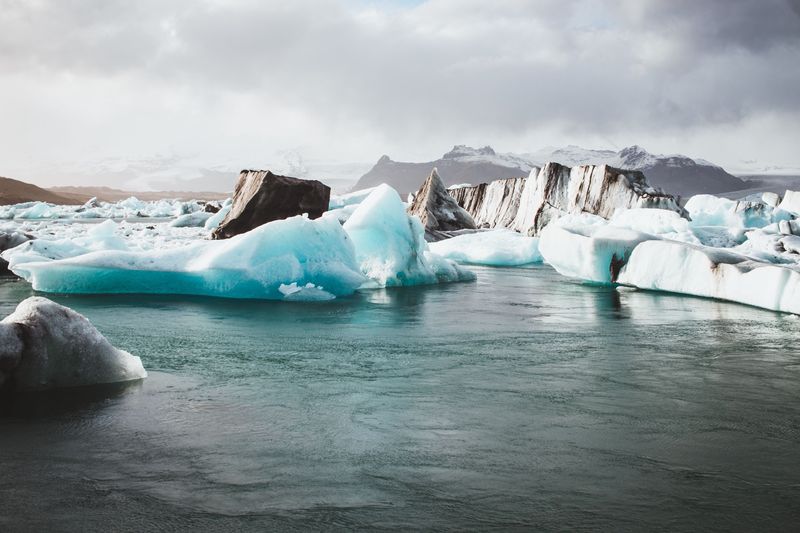
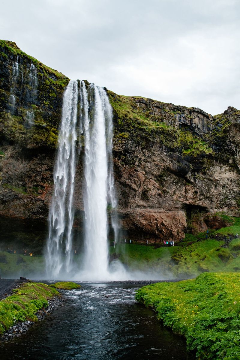
South Iceland has the greatest number of famous sights within easy reach of the capital. It includes the Golden Circle (Gullfoss, Geysir and Þingvellir), the waterfalls of Seljalandsfoss and Skógafoss, the black beaches around Vík, and the glaciers and lagoons of Vatnajökull National Park, including Jökulsárlón. It is the largest region by area, at about 31,000 km².
Because the Ring Road is usually open here all year, the south is also the best region for a winter road trip. See our stop-by-stop south coast guide and our Golden Circle guide.
What is there in West Iceland?
West Iceland runs from Akranes, just north of Reykjavík, to the Snæfellsnes peninsula and the Dalir valleys. Its highlights are Kirkjufell, the glacier volcano Snæfellsjökull, the Hraunfossar waterfalls and the Langjökull ice tunnel. It is close enough to Reykjavík for day trips, and it is a good choice if you want variety without the long drive east. Our Snæfellsnes peninsula guide has a one-day route.
Are the Westfjords worth the trip?
Yes, if you have time and come in summer. The Westfjords are the most remote region, with only about 7,000 people across almost 9,000 km² of steep fjords. Highlights include the 100-metre Dynjandi waterfall and the Látrabjarg bird cliffs, about 14 km long and up to 441 metres high at Iceland's westernmost point. Roads are long and winding, and many are gravel. June to September is the best time; in winter some routes close. Plan the route with our Westfjords road trip guide.
What is North Iceland best for?
North Iceland is best for volcanic landscapes, big waterfalls and whale watching. Akureyri, with about 20,000 people, is the largest town outside the capital area and a good base all year. From there you can reach Goðafoss, Lake Mývatn, Dettifoss, Ásbyrgi and Húsavík on the 250 km Diamond Circle. Humpback and minke whales feed in Skjálfandi Bay from about March to November. Read our full North Iceland guide.
What is there to do in East Iceland?
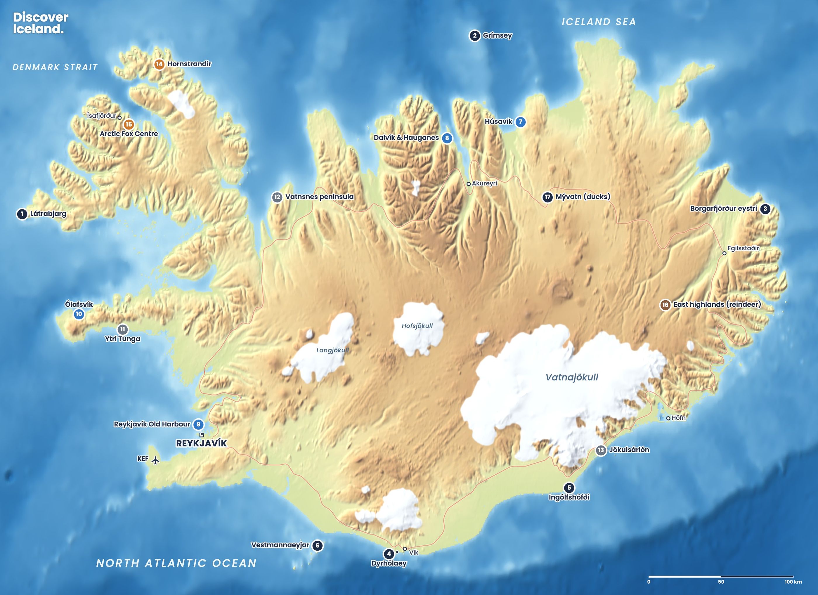
East Iceland is the quietest part of the Ring Road. The fjord villages, such as Seyðisfjörður, sit below steep mountains, and the East Fjords road is one of the most scenic drives in the country. Inland, Stuðlagil canyon has walls of basalt columns, and Hengifoss is the third-highest waterfall in Iceland at 128 metres. About 10,000 pairs of puffins nest at Borgarfjörður eystri from mid-April to mid-August. Egilsstaðir is the main town, with an airport, and the weekly Norröna ferry from Denmark arrives at Seyðisfjörður from mid-March to late November.
Can you visit the Icelandic highlands?
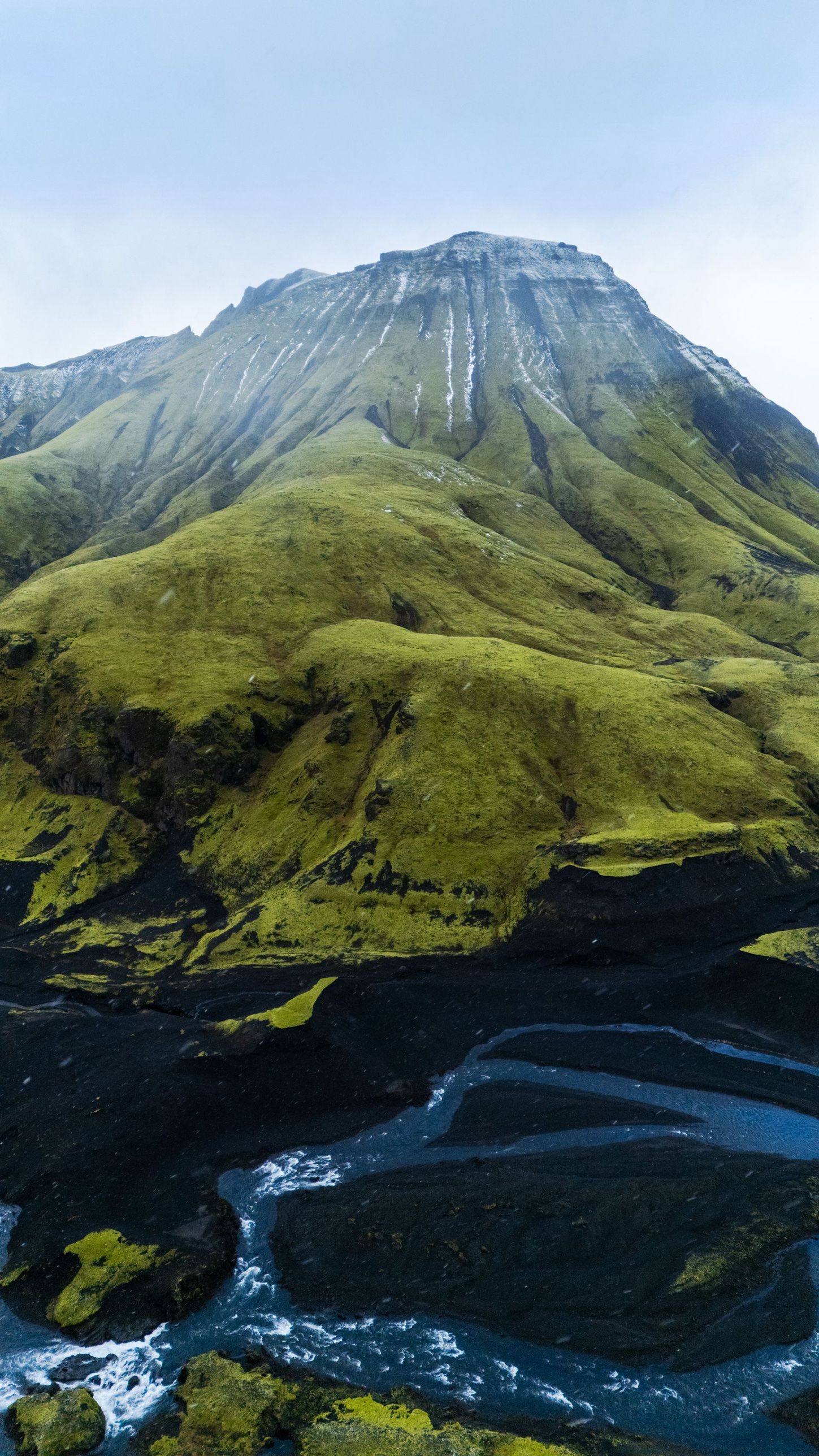
Only in summer, and only by 4x4, highland bus or tour. The interior is reached on F-roads, which usually open from mid or late June and close in September, with many unbridged rivers. Highlights include the coloured mountains of Landmannalaugar, the start of the Laugavegur trail, and the Askja caldera in the north. Iceland's glaciers, covering about a tenth of the country, sit on the edges of the highlands. Our Landmannalaugar hiking guide covers the most popular area.
Which region should you choose for your trip?
- 3–4 days: Reykjavík, the Golden Circle and the south coast to Vík.
- 5–7 days: add the glacier lagoons, or swap the south for a flight to Akureyri and the north.
- 7–10 days: drive the full Ring Road through the south, east and north.
- Two weeks: add Snæfellsnes and the Westfjords, or the highlands in summer.
- Winter: stay in one region, either the south or the north around Akureyri, and follow the weather.
For the top sights in every region on one map, read our guide to things to do in Iceland or open the interactive highlights map. To choose bases, see where to stay in Iceland. Our printed Complete Guide to Iceland also covers every region with maps for the road.
Distances look short on the map, but weather sets the pace. Check road.is and vedur.is every day, and allow spare time when you cross from one region to the next.
Facts checked October 2026. Population and area figures are 2025 official regional statistics. Highland road dates, ferry schedules and volcanic activity on Reykjanes change; check road.is, vedur.is and safetravel.is.
Sources
- Regions of Iceland (Wikipedia)
- The regions (Visit Iceland)
- Geography of Iceland (Wikipedia)
- Ground uplift and magma accumulation continue beneath Svartsengi (Icelandic Met Office)
- Látrabjarg bird cliff (Westfjords.is)
- Meet the puffins (Borgarfjörður eystri)
- Ferry to Iceland (Visit Iceland)
- The F-roads of Iceland (Blue Car Rental)