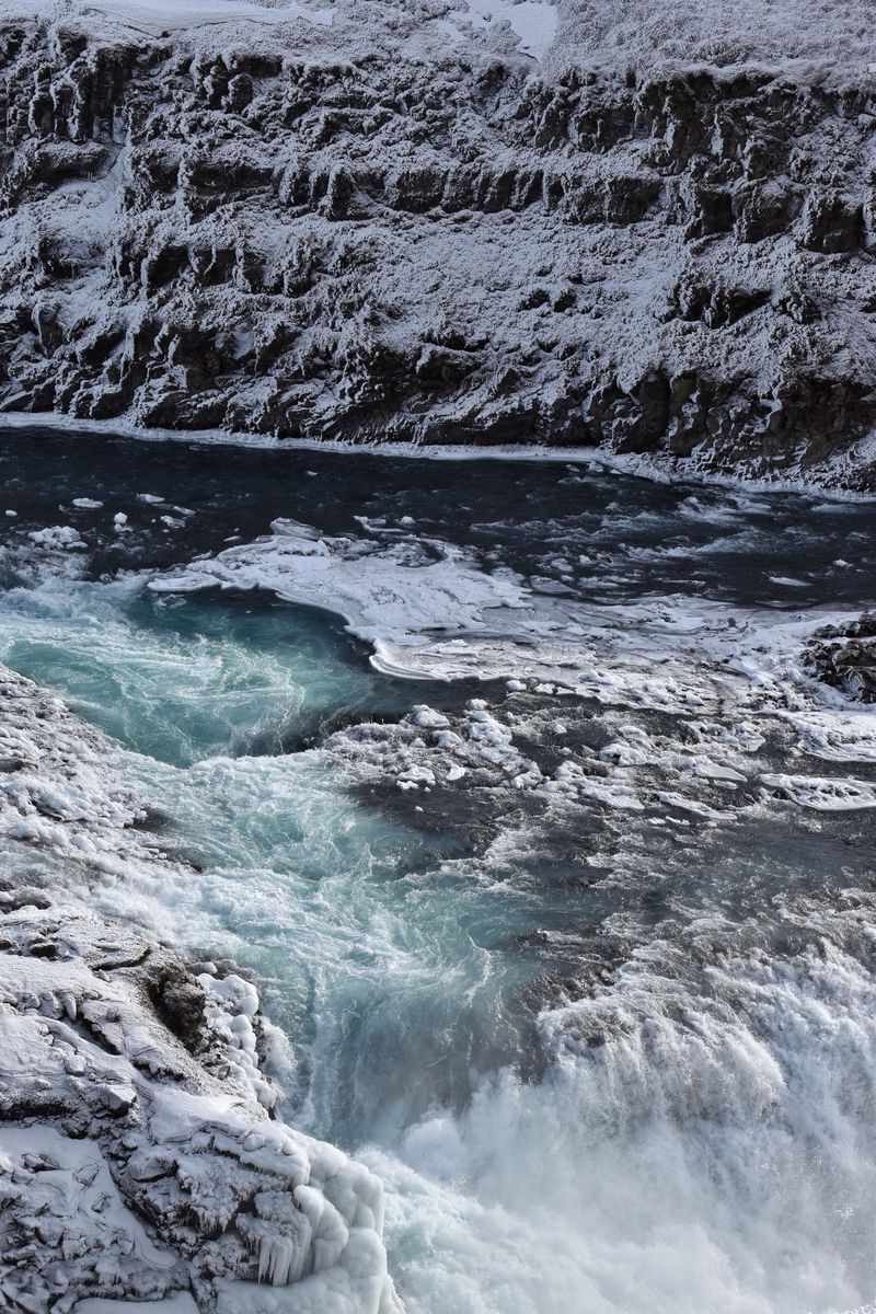
Dettifoss has two sides, and you choose by season and by how much effort you want. The west side, on paved road 862, has a large car park, platforms that face the falls and the only realistic access outside summer. The east side, on gravel road 864, is open only in summer, has less spray and lets you get closer. If you want one answer on the Dettifoss east or west question: go west unless you are travelling in summer and want the wilder side.
Should you visit Dettifoss from the east or the west?
For most visitors, the west side is the better choice. It is paved all the way, has the bigger car park, and its platforms look at Dettifoss head-on, so you see a larger part of the falls. It is also the only side with any winter road service.
The east side suits summer travellers who want a rougher, quieter visit. You see the falls from the side but can stand closer, and the spray usually blows the other way. It is also the side for Hafragilsfoss, the next waterfall downstream.
| West side (road 862) | East side (road 864) | |
|---|---|---|
| Road | Paved | Gravel, narrow, slow |
| From Route 1 | About 24 km, 20 min | About 32 km, 45 min |
| Season | Most of the year; limited winter service | Summer only, no winter service |
| View | Head-on, from platforms | From the side, closer to the edge |
| Spray | Often heavy | Little to none |
| Walk to Dettifoss | About 800 m to the upper viewpoint | About 400 m, steep and rocky |
| Car park | Large, with toilets | Small, fills up in summer |
What is Dettifoss?
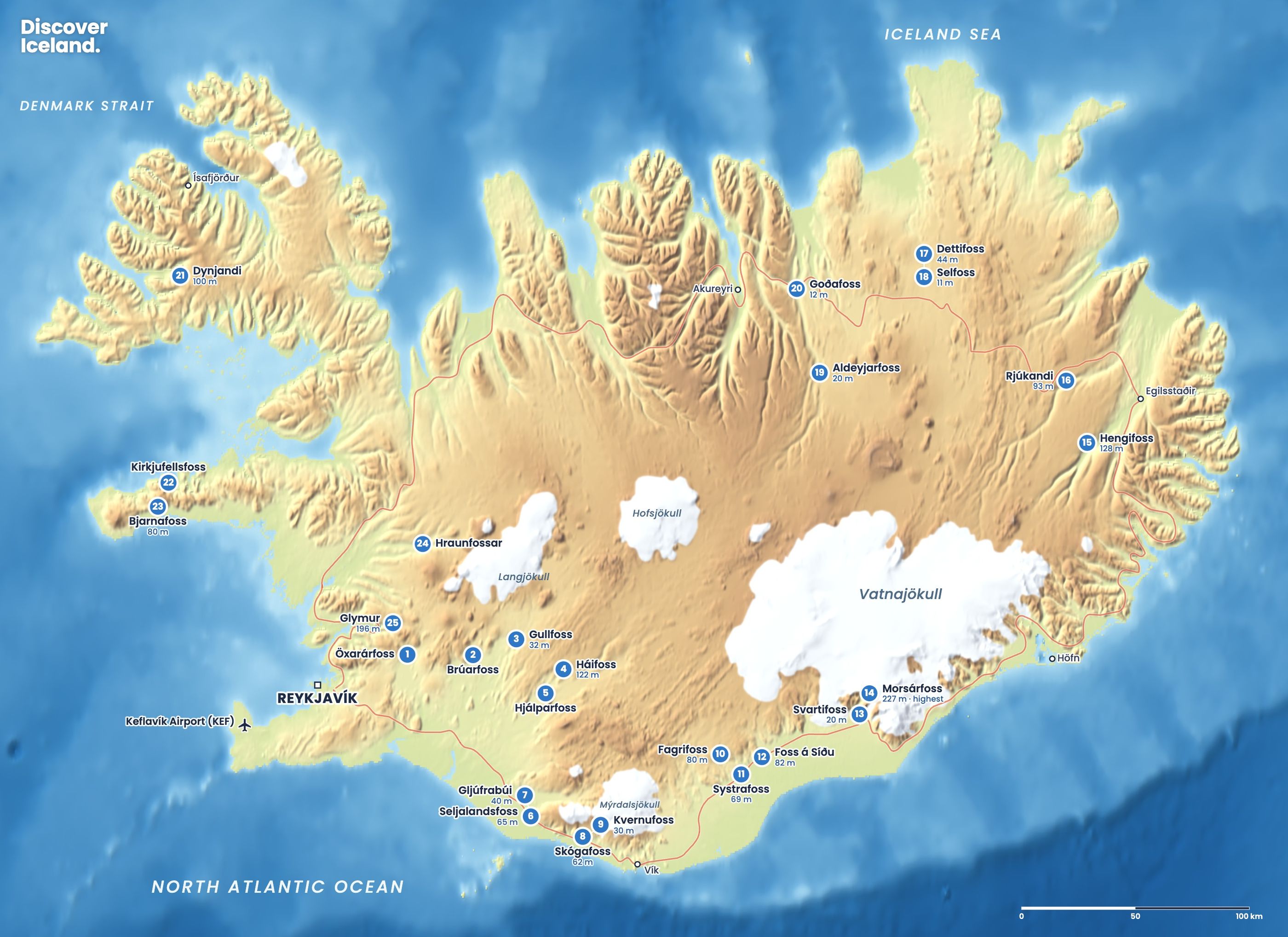
Dettifoss is a waterfall on the Jökulsá á Fjöllum, a glacial river flowing north from Vatnajökull. It drops 44 m into the Jökulsárgljúfur canyon and is about 100 m wide. With an average flow of 193 m³/s, it is described as the most powerful waterfall in Europe. The falls are inside Vatnajökull National Park, which reaches from the ice cap all the way north to this canyon.
Selfoss is a wider, lower fall, about 11 m high, a short walk upstream. Hafragilsfoss is a short distance downstream. A 34 km hiking trail follows the canyon from Dettifoss north to Ásbyrgi.
What is the west side of Dettifoss like?
The west side is the easy, well-built side. Road 862 is paved from Route 1 to the car park, about 24 km or 20 minutes, and roughly 45 minutes from Mývatn. The paved road continues north to Ásbyrgi and Route 85. It was opened in stages from 2010 to 2021 and completed the Diamond Circle loop.
From the car park it is about 800 m, mostly downhill, to the upper viewpoint. A steeper path leads down to a lower viewpoint, and the climb back up takes effort. The platforms face the falls, so you see the full width of the water.
The trade-off is spray. On many days the wind blows a heavy mist across the west platforms. Bring a waterproof jacket and a cloth for your lens, and on a windy day the upper viewpoint may not be worth the soaking.
What is the east side of Dettifoss like?
The east side is wilder and quieter. Road 864 is a narrow gravel road that runs between Route 85 and Route 1, about 45 minutes and 32 km from the Ring Road. Drive it slowly. It usually reopens around the end of May and closes again in autumn, depending on snow and mud.
The car park is small, and in summer it can fill by late morning. From there, a steep, rocky path of about 400 m takes about 10 minutes down to the falls. You can stand close to the edge here, and there is usually little spray, which makes it the better side for photos.
From the east car park it is a 3 km drive north to a separate lot for Hafragilsfoss. A few minutes' walk leads to a viewpoint over the canyon.
How do you walk to Selfoss?
Selfoss is about 1 km upstream of Dettifoss on both sides of the river. On the west side, a rocky trail of about 1 km leads from the lower Dettifoss viewpoint. The loop from the car park to Dettifoss, Selfoss and back is about 2.5 km and takes about an hour.
On the east side the trail to Selfoss is rougher, with some boulder scrambling, and the loop takes about 1.5 hours. From the west side you see only part of Selfoss, so the east side gives the fuller view.
Can you visit Dettifoss in winter?
Only from the west side, and not always. Road 864 on the east side has no winter service at all and is closed in winter. Road 862 on the west side gets some winter service until the end of December and again from around mid-March. Between those dates it is not serviced and can be closed by snow, and storms can close it at short notice at any time.
Check the road status on umferdin.is and the forecast on vedur.is before setting out, and turn back if conditions change. The paths to the viewpoints are icy in winter, so wear microspikes and stay well back from frozen edges. Our winter waterfalls guide covers the other northern falls.
If road 862 is closed, Goðafoss on the way between Akureyri and Mývatn is a reliable winter alternative. It is about 45 minutes from Akureyri.
Can you fly a drone at Dettifoss?
Only on the west side, and only within set times. Vatnajökull National Park allows recreational drones over the canyon on the west side of Dettifoss, not north of the northernmost viewing platform. Flying is banned in most of the rest of Jökulsárgljúfur. The allowed hours change by season, so check the park's drone rules before you fly.
What should you bring to Dettifoss?
Bring a waterproof jacket for the spray on the west side, and boots with good grip for the rocky paths, especially to Selfoss and the lower viewpoints. The paths are uneven and steep in places, so take your time. In the shoulder months and winter, add microspikes. There are no shops at the falls, so bring water and snacks, and fill up with fuel in Mývatn or on the Ring Road before you turn off.
How do you fit Dettifoss into a trip?
Most people visit Dettifoss on a day around Mývatn, or as part of the Diamond Circle with Húsavík, Ásbyrgi and Goðafoss. Driving the Ring Road from the east, it makes a natural stop on the way to Mývatn. Allow one to two hours for Dettifoss and Selfoss from one side.
See the North Iceland guide for the rest of the region, the Ring Road guide for routes, and Iceland's best waterfalls for every major fall on one map. The highlights map shows the other sights of the north.
Facts checked October 2026. Winter service on road 862 and the opening date of road 864 change with the weather each year; check umferdin.is and the Vatnajökull National Park pages before you go.