Iceland has around 30 active volcanic systems, and you can visit more of them than you might expect. You can hike to young lava fields near Reykjavík, ride a lift 120 m down into a dormant magma chamber, walk the rim of a tephra crater at Mývatn and drive past the glacier volcano that grounded Europe's planes in 2010. This guide maps 17 volcanoes, explains what each is known for and tells you which ones you can see, and how.
As of mid-October 2026 no eruption is under way in Iceland. Magma is still building up under Svartsengi on the Reykjanes Peninsula, so another eruption there is likely. Check the Icelandic Met Office at vedur.is and SafeTravel at safetravel.is before you go.
How many volcanoes are there in Iceland?
Iceland has around 30 active volcanic systems. A volcanic system is a family of craters, fissures and often a central volcano that share the same magma supply, so the number of individual peaks and craters is far higher. Over the last 500 years Iceland's volcanoes have produced about a third of all the lava erupted on Earth.
The reason is geology. Iceland sits on the Mid-Atlantic Ridge, where the North American and Eurasian plates pull apart, and above a hotspot that feeds extra magma from deep below. The plate boundary runs across the island from the Reykjanes Peninsula in the south-west to Krafla in the north-east. You can see the rift itself at Þingvellir, where the ground has cracked open into long fissures.
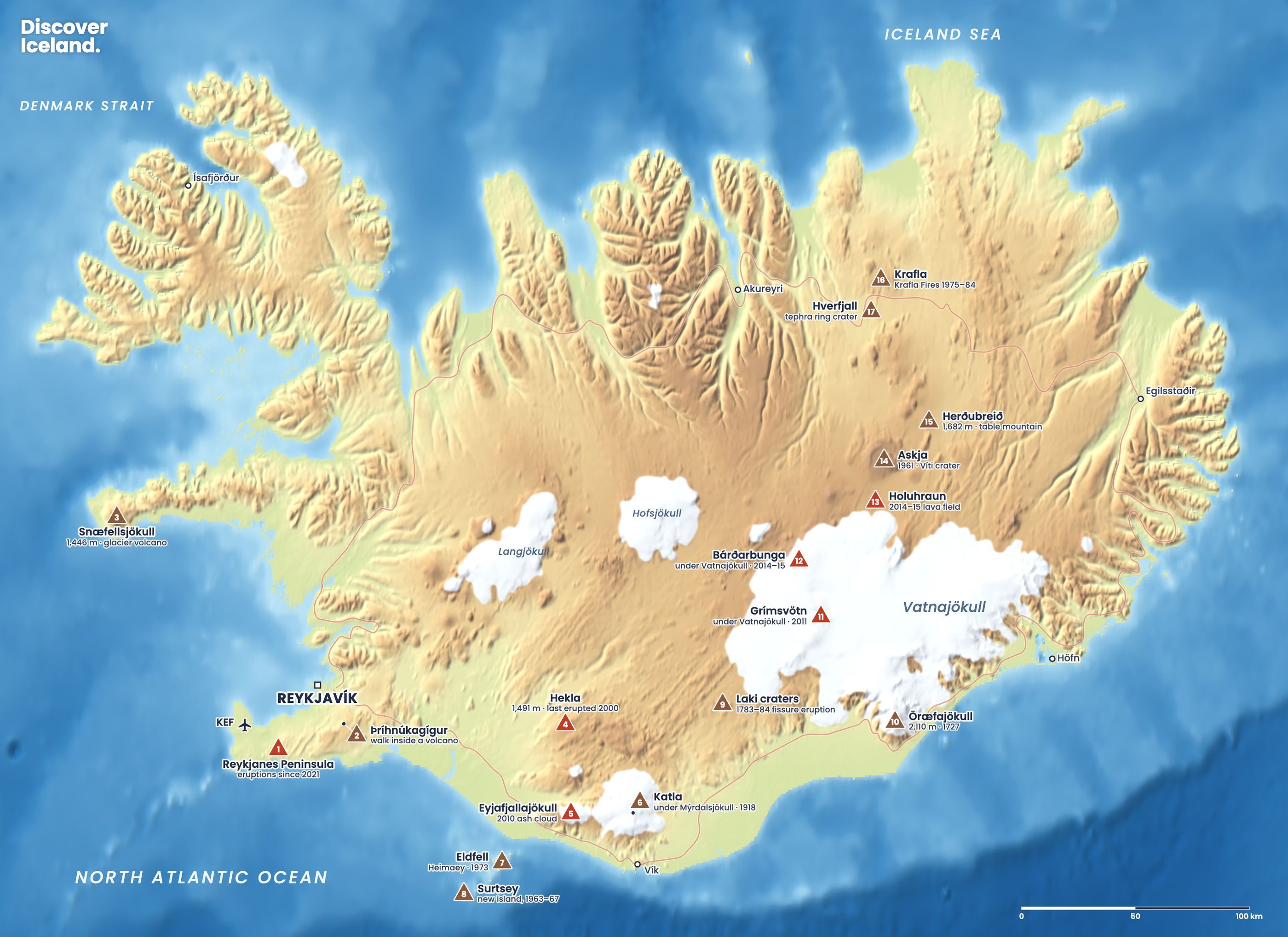
Which volcanoes are on the map, and can you visit them?
All 17 volcanoes on the map can be seen in some way, but only a few can be walked on or into. The table follows the map's numbers. Heights and dates are for the volcano or its best-known eruption.
| # | Volcano | Known for | How visitors see it |
|---|---|---|---|
| 1 | Reykjanes Peninsula | 12 eruptions since 2021 | Marked trails to the Fagradalsfjall lava fields |
| 2 | Þríhnúkagígur | Dormant magma chamber, about 120 m deep | Guided tour with a lift into the crater, May to October |
| 3 | Snæfellsjökull | Glacier-capped volcano, 1,446 m | From the roads around Snæfellsnes |
| 4 | Hekla | Iceland's most famous volcano, last erupted 2000 | From the south, or a summer hike in settled conditions |
| 5 | Eyjafjallajökull | The 2010 ash cloud | From the Ring Road on the south coast |
| 6 | Katla | Under Mýrdalsjökull, last major eruption 1918 | Glacier hikes on Sólheimajökull, its outlet glacier |
| 7 | Eldfell | Heimaey eruption, 1973 | A short climb on Heimaey, Westman Islands |
| 8 | Surtsey | New island, 1963–67 | Only from a boat or plane; landing is for scientists |
| 9 | Laki craters | The 1783–84 fissure eruption | Summer only, by 4x4 or highland tour |
| 10 | Öræfajökull | Highest volcano, 2,110 m; erupted 1727 | From Skaftafell and the Ring Road |
| 11 | Grímsvötn | Under Vatnajökull, erupted 2011 | Not accessible; under the ice cap |
| 12 | Bárðarbunga | Under Vatnajökull, 2014–15 unrest | Not accessible; under the ice cap |
| 13 | Holuhraun | Lava field from 2014–15 | Highland tours in summer |
| 14 | Askja | Last erupted 1961, Víti crater | Summer only, by 4x4 or highland tour |
| 15 | Herðubreið | Table mountain, 1,682 m | Seen on the way to Askja |
| 16 | Krafla | The Krafla Fires, 1975–84 | Paved road from Mývatn; walking trails |
| 17 | Hverfjall | Tephra ring crater | Short, steep path to the rim |
Is a volcano erupting in Iceland right now?
No. As of mid-October 2026 there is no eruption in Iceland. The most recent one was on the Sundhnúkur crater row near Grindavík, from 16 July to 5 August 2025.
That does not mean the Reykjanes Peninsula is quiet. On 30 September 2026 the Icelandic Met Office said the ground at Svartsengi was still rising slowly, by about 4 cm over three months, and that the most likely next step is a new magma intrusion towards the Sundhnúkur crater row, possibly ending in an eruption. Its August 2026 estimate put the magma stored under Svartsengi at about 29 million m³. The Reykjanes-Svartsengi system was at alert level 2, orange.
Elsewhere, the Met Office reported on 14 August 2026 that the uplift at Askja, under way since 2021, had stopped. Our Reykjanes volcano guide has the full timeline and what you can visit there.
Which volcanoes can you visit near Reykjavík?
Two of the most rewarding volcano experiences in Iceland are within an hour or so of the capital.
The Reykjanes Peninsula (1)
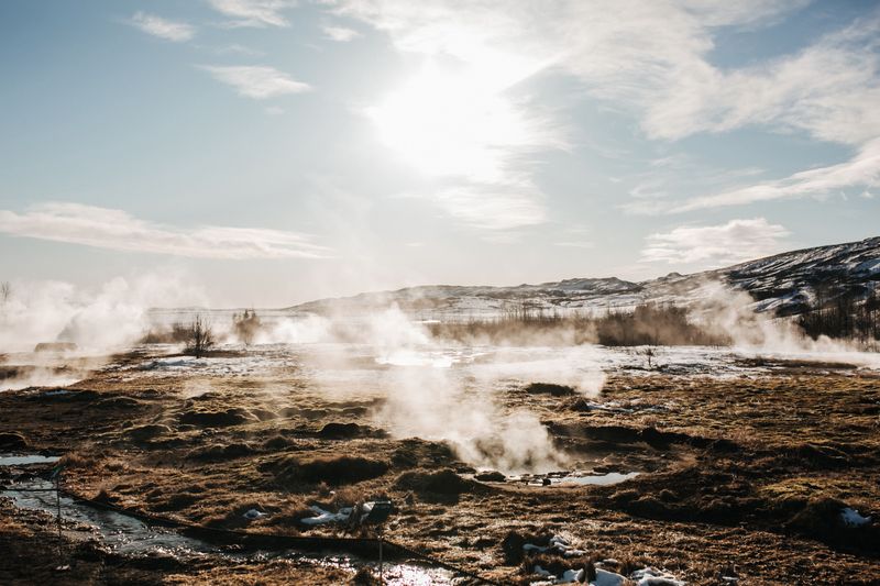
After about 800 years without an eruption, the Reykjanes Peninsula came alive in March 2021. Three eruptions at Fagradalsfjall in 2021, 2022 and 2023 were followed by nine on the Sundhnúkur crater row between December 2023 and August 2025. Marked hiking trails lead from paid car parks to viewpoints over the new lava, which is now the easiest place in Iceland to stand next to lava that is only a few years old.
Never walk on the new lava. It can stay hot for years under a thin crust. Closures change at short notice, and the town of Grindavík still sits inside the hazard zone.
Þríhnúkagígur (2)
In the Bláfjöll hills, about 20 km south-east of Reykjavík, Þríhnúkagígur is a volcano that last erupted about 4,500 years ago. Its magma drained away rather than hardening, which left a huge empty chamber. A guided tour lowers you about 120 m into it in an open lift. Tours run from May to October; see our guide to lava tunnels and Þríhnúkagígur for prices and the year-round lava caves nearby.
What are the famous volcanoes of the south coast?
Hekla, Eyjafjallajökull and Katla are the volcanoes most people have heard of, and all three sit close to the south coast route.
- Hekla (4), 1,491 m, has erupted 23 times in the last thousand years, most recently in February 2000. In the Middle Ages it was known across Europe as a gateway to hell.
- Eyjafjallajökull (5), 1,666 m, is the glacier volcano above Seljalandsfoss whose 2010 ash cloud closed most of Europe's airspace for several days.
- Katla (6) lies under the Mýrdalsjökull ice cap. It usually erupts every 40 to 80 years, and its last major eruption was in 1918.
You see Eyjafjallajökull from the Ring Road as you pass Seljalandsfoss. The guided glacier walks on Sólheimajökull take you onto an outlet glacier of Katla's ice cap, with dark bands of old ash in the ice. Our guide to Hekla, Katla and Eyjafjallajökull explains each one, including how to say the names.
Eldfell and Surtsey (7, 8)
Off the south coast, the Westman Islands have two of the most famous eruptions of the 20th century. In January 1973 a fissure opened on Heimaey, the only inhabited island, and built the cone of Eldfell. About 5,300 people were evacuated by fishing boat within a few hours. Today you can climb Eldfell from the town and look down on the lava that nearly closed the harbour.
Surtsey rose from the sea in an eruption that broke the surface on 14 November 1963 and ended on 5 June 1967. It is a UNESCO World Heritage Site, and only a few scientists may land there, so you see it from a boat or a sightseeing flight.
Which volcanoes are under Vatnajökull?
The Vatnajökull ice cap covers several active volcanoes. You cannot visit them, but they shape everything around the Vatnajökull area.
- Laki (9) is a row of craters south-west of the ice cap. Its 1783–84 eruption released about 15 km³ of lava, and the famine and livestock deaths that followed killed roughly a fifth of Iceland's people. The craters can be reached in summer by 4x4 or on a tour.
- Öræfajökull (10) is Iceland's highest volcano at 2,110 m. Its summit, Hvannadalshnúkur, is the country's highest peak, and its slopes rise straight above Skaftafell. It last erupted in 1727.
- Grímsvötn (11) lies beneath the middle of the ice cap and is one of Iceland's most active volcanoes. Its May 2011 eruption disrupted about 900 flights at first.
- Bárðarbunga (12) fed the Holuhraun eruption of 2014–15 through a dyke more than 40 km long, while its ice-filled caldera sank.
Which volcanoes can you see in the north and the highlands?
The north-east has the widest range of volcanic landscapes you can walk through. Some are a short drive from Mývatn; others need a summer 4x4 trip into the highlands.
Holuhraun, Askja and Herðubreið (13, 14, 15)
Holuhraun is the lava field from Iceland's largest eruption in about 230 years, which ran for around six months from late summer 2014 into early 2015. It lies about 20 km south of Askja.
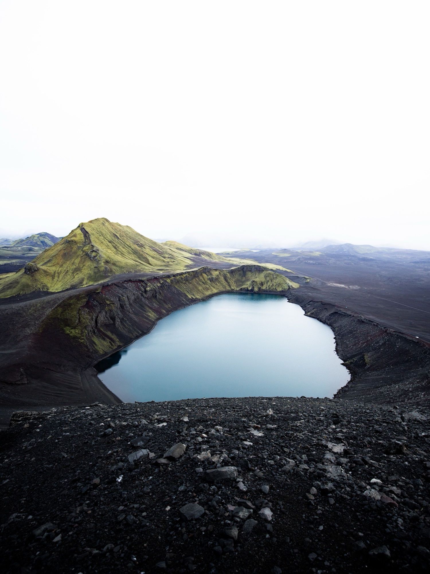
Askja is a vast caldera in the central highlands. Its eruption in 1875 left the lake Öskjuvatn, which is 220 m deep and Iceland's second-deepest lake. Beside it is Víti, a smaller crater about 2.5 km on foot from the car park. Askja last erupted from 26 October to 5 December 1961. The roads in are F-roads, usually open only from late June to early October, so most visitors join a tour from Mývatn.
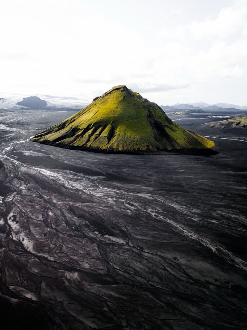
On the way you pass Herðubreið, a 1,682 m table mountain. Its flat top and steep sides formed when it erupted under the thick ice of the last ice age.
Krafla and Hverfjall (16, 17)
Krafla is a caldera about 10 km across, east of Mývatn. Between 1975 and 1984 it went through the Krafla Fires: nine eruptions and fifteen rounds of uplift and subsidence. Marked paths cross lava from that period, and you can look into Víti, a crater with a green lake. A geothermal power station has used the heat here since 1977.
Hverfjall is a tephra ring crater about 1 km across that formed in an explosive eruption roughly 2,500 years ago. A short, steep path climbs to the rim, and a loop of about 3 km follows it round, with views over Mývatn. A parking fee applies at the main car park.
Which volcano is in the west of Iceland?
Snæfellsjökull (3) is a 1,446 m glacier-capped volcano at the tip of the Snæfellsnes peninsula. On a clear day you can see it across the bay from Reykjavík. It is best known as the entrance to the underworld in Jules Verne's novel Journey to the Centre of the Earth. The roads around the peninsula show it from every side, along with lava fields, craters and black beaches.
What kinds of volcano does Iceland have?
Iceland has almost every type of volcano, and knowing them helps you read the landscape.
| Type | What it looks like | Examples on the map |
|---|---|---|
| Fissure eruption | A long crack with a row of small craters and fountains of lava | Reykjanes, Laki, Holuhraun, Krafla |
| Stratovolcano | A tall, layered cone or ridge built by many eruptions | Hekla, Snæfellsjökull, Öræfajökull |
| Subglacial volcano | Hidden under ice; eruptions melt the ice and cause floods and ash | Katla, Grímsvötn, Bárðarbunga, Eyjafjallajökull |
| Table mountain | Flat-topped, steep-sided mountain formed under an ice sheet | Herðubreið |
| Tephra ring | A wide, low crater of loose ash and rock from an explosive blast | Hverfjall |
| Caldera | A huge hollow where the ground sank after an eruption | Askja, Krafla, Katla |
The type matters for travel. Fissure eruptions like those on Reykjanes produce lava but little ash, which is why Keflavík Airport has kept operating through the recent eruptions. Eruptions under glaciers are the ones that can send up ash clouds or flood rivers.
Is it safe to visit Iceland's volcanoes?
Yes, if you follow closures and stay on marked paths. Iceland's volcanoes are among the most closely monitored in the world, and authorities close roads and areas quickly when the risk rises. The real dangers near an eruption are local:
- Volcanic gas is often invisible and can pool in hollows and valleys. Check the gas forecast before you go.
- New lava looks solid long before it is safe. Never step on it.
- New fissures can open with little warning near an active area.
- Glacier volcanoes can melt ice and send floods down rivers. Respect road closures on the south coast.
Our Iceland volcano safety guide covers gas, flights, closures and the official sources to check.
Before any volcano trip, check three things: the Icelandic Met Office at vedur.is, alerts and closures at safetravel.is, and road conditions at umferdin.is.
What are the best volcano experiences in Iceland?
You do not need an eruption to get close to Iceland's volcanoes. These are the most popular ways in, from easy to more committed.
- Walk to the Reykjanes lava fields. Marked trails from paid car parks lead to the 2021–23 Fagradalsfjall lava and viewpoints over the Sundhnúkur craters.
- Go underground in a lava tunnel. Raufarhólshellir, about 30 km from Reykjavík, is open all year on guided tours.
- Descend into Þríhnúkagígur. The only tour of its kind, from May to October.
- Visit an exhibition. The LAVA Centre in Hvolsvöllur explains Iceland's volcanoes, including the 2010 Eyjafjallajökull eruption.
- Climb Eldfell on Heimaey. A short climb up a cone that formed in 1973.
- Walk at Krafla and Hverfjall. Lava, craters and steam vents a short drive from Mývatn.
- Join a summer highland tour to Askja. A long day in a 4x4 for the caldera, Víti and Holuhraun.
When is the best time to visit Iceland's volcanoes?
Summer is the best time for most volcanoes. From late June to early September the highland roads to Askja, Holuhraun and Laki are usually open, the trails are clear of snow and you have long days. See our guide to the best time to visit Iceland for month-by-month weather.
The Reykjanes trails, the lava tunnels near Reykjavík, Krafla and Hverfjall can be visited much of the year, but winter brings ice, snow and very short days. Þríhnúkagígur runs only from May to October. If an eruption starts, tour operators run trips only when authorities allow it, which is often the safest way to see one.
For the wider picture of what to see between volcanoes, our Iceland highlights map shows the main sights, and our printed Complete Guide to Iceland covers the volcanic regions in more depth.
Facts checked October 2026. Volcanic activity changes fast, especially on the Reykjanes Peninsula: check vedur.is and safetravel.is before you travel. Highland road opening dates and tour seasons change every year.