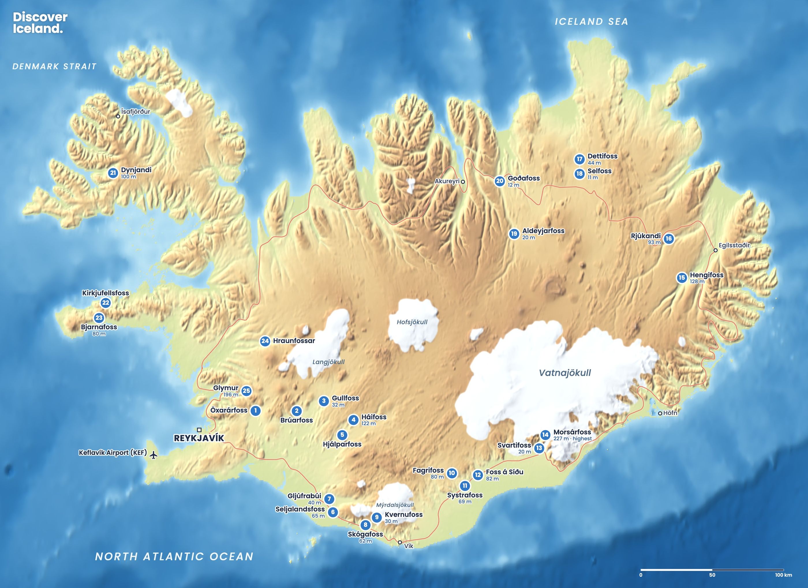
The best East Iceland waterfalls are all within reach of Egilsstaðir. Hengifoss, at 128 m the third-highest in the country, is a 5 km return hike that also passes Litlanesfoss and its basalt columns. Fardagafoss and Gufufoss are short stops on road 93 to Seyðisfjörður, and Rjúkandi falls beside Route 1 in Jökuldalur. Together they make an easy day from Egilsstaðir.
What are the best waterfalls in East Iceland?
| Waterfall | Height | Where | Walk |
|---|---|---|---|
| Hengifoss | 128 m | Fljótsdalur, south-west of Egilsstaðir | About 2.5 km each way, 40–60 min up |
| Litlanesfoss | About 25–30 m | Halfway up the Hengifoss trail | About 20–30 min up |
| Fardagafoss | About 20 m | Road 93, about 5 km from Egilsstaðir | About 2.6 km return |
| Gufufoss | About 27 m | Road 93, above Seyðisfjörður | Roadside |
| Rjúkandi | About 93 m | Route 1, Jökuldalur | Short stop |
If you only have time for one, choose Hengifoss. If you have an hour, Fardagafoss and Gufufoss fit easily into a drive to Seyðisfjörður.
How do you hike to Hengifoss?
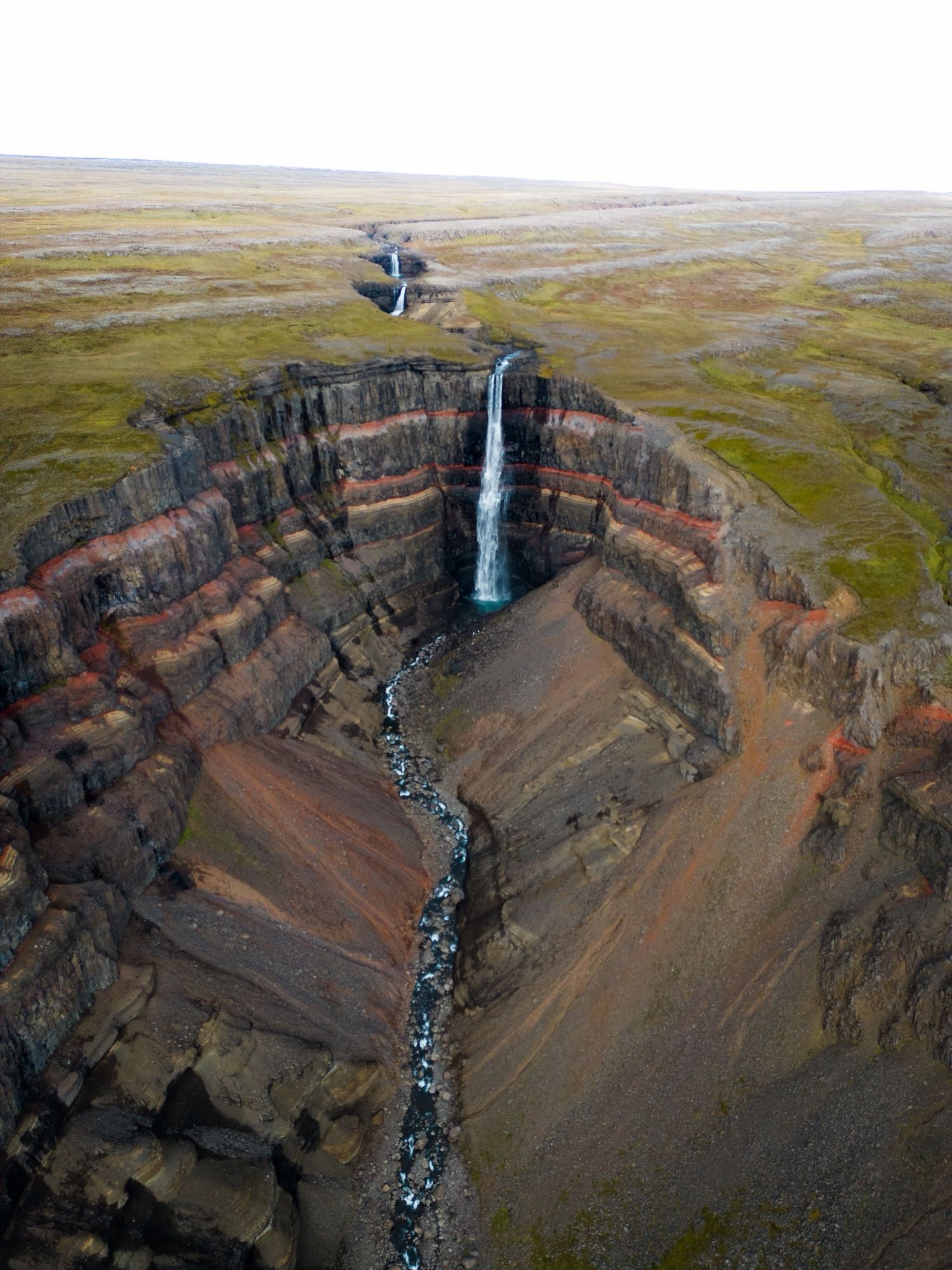
Hengifoss is a 128 m waterfall on the Hengifossá river in Fljótsdalur. The hike is about 2.5 km each way, around 5 km in total. It climbs about 250 to 300 m and is steepest near the start. Allow 40 to 60 minutes up and 1.5 to 2 hours in total with stops.
What makes Hengifoss different is the cliff behind it. Bands of black basalt alternate with thin red layers, like a layer cake. At the base are sedimentary layers about 5 to 6 million years old, with lignite at the top, the remains of an ancient forest.
The trail ends at a viewpoint in front of the falls. Do not continue into the gorge below the cliff, especially in winter, when ice can fall.
Is the Hengifoss hike difficult?
The Hengifoss hike is moderate. It is a steady uphill walk on a clear path, and most reasonably fit walkers manage it without trouble. The steepest section is near the start, and benches along the trail give you places to rest. Walking boots are better than trainers, because the path is loose and stony in places and can be muddy after rain.
Coming down is quicker but harder on the knees. In winter and early spring the trail can be icy, and traction spikes make a big difference. If the weather turns, Litlanesfoss is a good point to turn back.
What is Litlanesfoss?
Litlanesfoss is the smaller waterfall you pass about halfway up the Hengifoss trail. It drops about 25 to 30 m in two steps and is surrounded by unusually tall columns of basalt. Many people think it is the more photogenic of the two, and it is a natural place to rest on the climb.
How do you get to Hengifoss, and is there a fee?
Hengifoss is in Fljótsdalur, beyond Lagarfljót, the long lake south-west of Egilsstaðir. Route 931 runs around the lake. You can drive via Fellabær on the north side, or via Hallormsstaðaskógur forest on route 95 and then route 931. The distance is similar either way.
The car park has a service building with toilets, and rangers are on site in summer. Parking costs about ISK 1,000 per car for the day (2026). Cameras read number plates, so pay at the kiosk or online before you leave. Stops of under 15 minutes are free.
If the Hengifoss car park is full, the Skriðuklaustur visitor centre is about 5 km further along the road.
Where is Fardagafoss?
Fardagafoss is about 5 km from Egilsstaðir on road 93, at the foot of the Fjarðarheiði pass. It is one of three waterfalls on the Miðhúsaá river. A marked trail leads from a small parking area by the road, about 2.6 km there and back. The walk is easy, but the final section to the falls is a bit tricky.
The fall is about 20 m high, and you can walk behind it to the remains of an old cave. Local legend says a giantess lived in the cave. She is said to have hidden a cauldron of gold in a pothole at Gufufoss, and its handle is supposed to show when the river is low. The path is slippery after rain, so treat it as a summer walk. See waterfalls you can walk behind for more like it.
Where is Gufufoss?
Gufufoss is on road 93 as it descends from the Fjarðarheiði pass into Seyðisfjörður. It is about 27 m high and sits on the south side of the road. Coming from Egilsstaðir, it is easy to miss on the way down. There is a pull-off on the right as you head toward Seyðisfjörður.
If you miss it, drive into Seyðisfjörður and stop on the way back up. Seyðisfjörður also has its own waterfall walk, the Vestdalsfossar trail.
What is Rjúkandi?
Rjúkandi is a tall waterfall beside Route 1 in Jökuldalur, north-west of Egilsstaðir. It is listed at about 93 m. It makes a good 20 to 30 minute stop if you are driving the Ring Road between Mývatn and Egilsstaðir.
What else is near these waterfalls?
Stuðlagil canyon, with its basalt columns and blue-green river, is in Jökuldalur and pairs well with Rjúkandi. In the south of the region, the East Fjords road follows the coast past small fishing villages. The Hallormsstaðaskógur forest on Lagarfljót is on the way to Hengifoss.
For the waterfalls further north, read Dettifoss: east or west side?
How do you see East Iceland's waterfalls in one day?
From Egilsstaðir you can see the main East Iceland waterfalls in one relaxed day. A sensible order:
- Morning: Hengifoss and Litlanesfoss. Drive around Lagarfljót on route 931 and allow two hours for the hike. Arrive early in summer, when the car park fills.
- Lunch: Egilsstaðir. The town has shops, cafés and fuel.
- Afternoon: Fardagafoss. About 5 km out on road 93; allow an hour for the walk.
- Late afternoon: Gufufoss and Seyðisfjörður. Continue over the pass and stop at Gufufoss on the way down into town.
If you are arriving from the north on the Ring Road, stop at Rjúkandi and detour to Stuðlagil on the way into Egilsstaðir.
When can you visit East Iceland's waterfalls?
June to September is the best time. The trails are dry, the days are long, and road 93 over Fjarðarheiði is usually clear. In winter the Hengifoss trail is icy, so take microspikes and turn back if it is unsafe. Fjarðarheiði is a high mountain pass and can close in storms. Check umferdin.is and vedur.is before driving it.
For a full trip around the island, see the Ring Road guide, and for every waterfall on one map, Iceland's best waterfalls.
Facts checked October 2026. Parking fees and trail conditions change; winter conditions on road 93 and the Hengifoss trail vary from day to day, so check umferdin.is before you go.